Buffalo Gap National Grassland
Coordinates: 43 ° 29 '47 " N , 102 ° 53' 21" W.
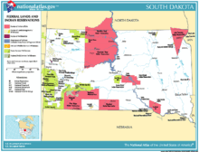
Buffalo Gap National Grassland is a protected area ( United States National Grassland ) in the state of South Dakota . At 2,410.77 km², it is the second largest of its kind. Buffalo Gap National Grassland was created on June 23, 1960 on the initiative of the federal government by the United States Forest Service . Originally part of the Great Sioux Reservation , the area was settled by white settlers due to the Homestead Act and the Dawes Act . The core of the present-day protected area arose from farms that had to be abandoned during the Great Depression of the 1930s in the prairie areas of the Midwest due to persistent drought ( Dust Bowl ). The federal government bought the farms, designated them as National Grasslands and renatured the original prairie . In the 1940s, parts of the area were used as a training area and bomber dropping test area by the United States Army Air Forces . Since then, the South Dakota National Guard has used parts of the site as an artillery training area. Buffalo Gap National Grassland is bordered by the Pine Ridge Indian Reservation , Badlands National Park and Oglala Grassland in Nebraska . The grassland is administratively divided into two districts, eastern and western. The headquarters of the eastern district is in Wall, and that of the western district in Hot Springs.
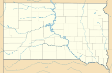
Buffalo Gap National Grassland includes portions of Fall River County , Pennington County , Jackson County , and Custer County , all of which are located in South Dakota.
history
Originally the area was populated by Arikaree Indians. In the late 18th and early 19th centuries, wars and smallpox epidemics severely decimated them. The few surviving Indians then concentrated in Fort Berthold to the north, where they still have a reservation together with the Mandan and the Hidatsa , the Fort Berthold Reservation . The Sioux , who were actually from eastern Minnesota , immigrated to the area. The Sioux migrated for several reasons. One of the reasons was that the warring Cree Indians had been armed with rifles by the French, while the Sioux continued to fight with bows and arrows. Originally, the Sioux were semi-settled, practiced agriculture to a limited extent and lived from hunting and fishing. In 1776 the first Lakota Sioux Indians reached the area and the Black Hills to the west . The culture and life of the Lakota changed. Her life was now dominated by bison hunting. Tipis replaced earth dwellings and horses began to play an important role in their culture.
At that time, the French claimed the area. Except in the fur trade, they were not particularly active. Except for a few scattered trading posts, they developed no further settlement activities. In 1803, the United States bought the area from the French as part of the Louisiana Purchase . Even these did not initially show any major settlement activities. The Sioux were feared as warriors, and development was long considered impossible.
After the Red Cloud War (1866–1868), which ended happily for the Sioux , the Sioux negotiated with the American federal government. They reserved large areas for themselves by the second Treaty of Fort Laramie in 1868 . The treaty laid the area of the entire present-day US state of South Dakota west of the Missouri, including the Black Hills (from the northern border in Nebraska to the 46th parallel and from Missouri in the east to the 104th meridian in the west) as Indian land unrestricted and unmolested use and settlement by the Great Sioux Nation . The Great Sioux Reservation was born.
After several lost wars, the reservation was divided into several small reservations by the United States Congress on March 2, 1889. They lost the territory through the Dawes Act. The Dawes Act provided individual land ownership for Indian families. Many Indians had no private ownership of land and often sold their land to white settlers or speculators out of ignorance or economic hardship. The undivided areas and parcels that fell to the state after the owners died were sold to white buyers at bargain prices. The reserve land was divided into 160 acres and given to each head of the Indian family for their sole use. All unmarried reserve residents over 18 years of age and minor orphans received 80 acres, children under 18 received 40 acres, wives nothing. However, the plots of land, which were often fruitless, only became the property of the Indians after 25 years. The US government acted as trustee.
After clearing the prairie grass, the white settlers primarily grew wheat. This had fatal consequences and the reclamation resulted in massive droughts. The deep roots of the prairie grass, the stalks of which caught the dust, had protected the upper layers of soil from erosion, which was now setting in on a massive scale. The harvests were destroyed by drought and dust storms and people were literally blown into their homes.
Between 1933 and 1938, many farmers had to leave their land when their financial resources were exhausted. They often looked for work in other regions of the United States, particularly in agricultural production in California. Here they competed with other migrant workers. At that time, the USA was hit hard by the global economic crisis and recorded extremely high unemployment (see Dust Bowl ).
In 1937 the Bankhead-Jones Farm Tenant Act was passed. The federal government bought the area. The federal government bought farms on a large scale that had been affected by the great drought and renatured the original prairie. A return to the Lakota Indians and the Pine Ridge Indian Reservation was not considered. Parts of the area were used for military purposes during World War II. The Buffalo Gap National Grassland was officially created on June 23, 1960 on the initiative of the federal government by the United States Forest Service.
Claims of the Lakota
Although the Lakota Indians primarily claim areas in the Black Hills, they also claim the Buffalo Gap National Grasslands and Badlands National Park.
Release of the black-footed polecat
The grassland became famous for the release of the endangered black-footed turtle . Releases have been carried out in Badlands National Park and Buffalo Gap National Grasslands and have been successful. Between 1994 and 2001 a total of 225 young animals were born, the population living there was estimated at 200 individuals. In 2005 the total population was again an estimated 500 specimens.
Web links
- Buffalo Gap National Grassland, Grassland region, South Dakota, United States (English)
- The National Grasslands Story (English)
Individual evidence
- ↑ World War II Comes to the Badlands The Badlands Gunnery Range
- ^ The SD National Guard plans on going into the Buffalo Gap National Grasslands between Highway 44 and Highway 40
- ↑ The eastern district, headquartered in Wall, runs along the northern border of the Pine Ridge Reservation of the Oglala Sioux and almost completely surrounds the northern part of Badlands National Park. The western district, headquartered in Hot Springs, extends south along the western border of the Pine Ridge Reservation and occupies the southwestern corner of the state. Oglala National Grassland in Nebraska adjoins it to the south
- ^ History of South Dakota Herbert S. Schell, 2004, South Dakota State Historical Society Press, ISBN = 0-9715171-3-4
- ↑ Contract text in English
- ^ Paul A. Johnsgard: Great Wildlife of the Great Plains . University Press of Kansas, 2003, ISBN 0-7006-1224-6 , p. 63


