Butterworth Hall Brook
| Butterworth Hall Brook | ||
|
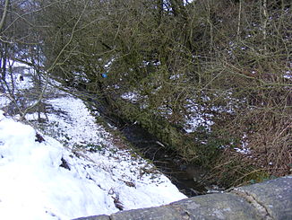
Butterworth Hall Brook down from Claylands Head |
||
| Data | ||
| location | Greater Manchester , England | |
| River system | River Mersey | |
| Drain over | River Beal → River Roch → River Irwell → River Mersey → Irish Sea | |
| River basin district | North West | |
| source |
Tunshill 53 ° 36 ′ 48 ″ N , 2 ° 5 ′ 15 ″ W. |
|
| muzzle | in Milnrow in the River Beal Coordinates: 53 ° 36 ′ 26 " N , 2 ° 6 ′ 30" W 53 ° 36 ′ 26 " N , 2 ° 6 ′ 30" W
|
|
The Butterworth Hall Brook is a stream in Greater Manchester in England . It flows through the village of Milnrow and is a tributary of the River Beal .
history
Part of the river bed was a former bridle path called Water Lane . In the meantime, this can no longer be used because the watercourse of Butterworth Hall Brook flows through it for the most part.
Individual evidence
- ↑ Rochdale Observer (English)
