Buttevant
| Buttevant Cill na Mallach |
|||

|
|||
| location | |||
| Coordinates: | 52 ° 14 ′ N , 8 ° 40 ′ W | ||
|
|||
| Data | |||
| Province: | Muenster | ||
| County: | Cork | ||
| Height: | 95 m above sea level NHN | ||
| Residents: | 1,667 (2006) | ||
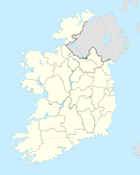
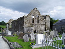
The small rural community of Buttevant ( Irish : Cill na Mallach ) is located on the N20, about 10 kilometers north of Mallow in County Cork in Ireland . On the main street, next to the parish church, there are the ruins of the former Buttevant monastery and the remains of the Ballybeg monastery about a kilometer south of Buttevant . There are 124 prehistoric monuments in the municipality, a number that is not atypically high for Cork and the entire Republic of Ireland .
Menhirs
The probably oldest monuments are four menhirs ( English Standing Stones ). They are located in the townlands of Boherascrub East, Bregoge, Currymount and Velvetstown. Three of the four standing stones stand near the Kilmacklenine hallway.
Although limestone is available in the area , exotic types of rock have been used. Large blocks of "Preference was given to Old Red Sandstone " by the glaciers of the Ice Age from the Ballyhoura Mountains "were relocated and Galway - Granite ".
Kilmaclenine
Kilmaclenine's or Acuthogue's Wedge Tomb is 3 miles southwest of Buttevant. The tall, box-like, above-ground west-east oriented structure of the Wedge Tomb type was excavated and contained a skeleton, a sword and a few pearls. The over 2.75 meter long capstone rests on two supporting stones and an end stone. The chamber is very high for the guy with over 1.5 meters. It appears to be in a massive hill that has been mutilated over the millennia. "Wedge Tombs" (German "Wedge Graves", formerly also called "wedge-shaped gallery grave") are aisle-less, mostly undivided megalithic buildings from the late Neolithic and early Bronze Age .
Burnt Mounds (Fulachta Fiadhs)
Of the 14 burnt mounds that have been recognized so far and are very common in southern Ireland , six are in the Templemary hall, three in the Ardaprior hall. The remaining five are in the hallways of Ballyvorisheen, Curraglass, Currymount, Dreenagh West and Velvetstown.
Piles of medium-sized burned stones are the main feature of the Fulachta Fiadh. The squares weren't settlements. There are no studies or descriptions of the 14 plants in Buttevant.
Ring forts
The 67 known ring forts are the main type among the monuments at Buttevant.
They were built over a period of over 1,500 years. The earliest could be 500 BC. BC, the last 1000 AD. It is estimated that around 30,000 to 40,000 ring forts were successively built in Ireland. The average distribution in Ireland is one ring fort per 425 acres . The density in Buttevant is about twice that.
Ring forts made of earth walls, like those at Buttefant, are called Lios or Rath . Where they were built from stones, such as B. in County Clare , they are more likely to be called Dun , Cashel or Cathair. Although they are generally called "Ringfort", they had no military function.
Basement
So far, only four basements have been recognized in the Buttevant area . They are located in the Ballyvorisheen, Dreehagh West, Grange East and Rathclare hallways. This means that a type of system that is almost typical for County Cork is underrepresented. In the case of basements , a distinction is made between “earth-cut”, “rock-cut”, “mixed”, “stone built” and “wooden” (e.g. Coolcran, County Fermanagh ).
Basements are generally closely connected to ring forts . They were made from 500 BC. And are associated with the La Tène culture of Ireland.
One of the oldest columbaria (dovecotes) in Ireland, which is a separate genus of finds, is located south of Buttevant near Ballybeg Monastery.
The Buttevant horse race
In 1752 one of the first documented horse hunting races took place between the steeples of the church in Buttevant and that in Doneraile .
literature
- Mark Clinton: The Souterrains of Ireland , 2001, ISBN 1-869857-49-6
- Peter Harbison : Guide to National and Historic Monuments of Ireland . Gill and Macmillan, Dublin 1992, ISBN 0-7171-1956-4 .

