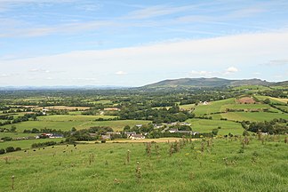
Ballyhoura Mountains
| Ballyhoura Mountains at Sliabh Riabhach |
||
|---|---|---|
|
Ardpatrick with a foothill of the Ballyhoura Mountains in the background |
||
| Highest peak | Seefin ( 528 m ASL ) | |
| location | County Cork , County Limerick ( Ireland ) | |
|
|
||
| Coordinates | 52 ° 18 ′ N , 8 ° 32 ′ W | |
The Ballyhoura Mountains ( Irish An Sliabh Riabhach , English Bez. Of Bealach Eabhra , the Irish Bez. For the townland of Ballyhoura ) form a mountain range in the northeast of County Cork and in the southeast of County Limerick . It runs in a west-east direction along the border of the two counties in the Irish province of Munster .
description
The highest mountain in the Ballyhoura Mountains is the 528 m high Seefin ( Suí Finn ). He is not to be confused with the Seefin in County Wicklow . Near the Seefin is the 516 m high Black Rock in the northwest . To the east of the Seefin is the Knockea ( Cnoc Aodha , approx. 400 m) and to the east of this the Knockeennamroanta (402 m). Between the two, the Barnaderg Pass ( Bearna Dhearg , also known today as Redchair) connects the Limerick Plain with the Cork Plain. At the time of the Irish high king Brian Boru in the 10th and 11th centuries, numerous battles took place at this pass. On the north side of the valley is the summit of Barnageeha (approx. 365 m). About 5 km west of the Seefin is the Carron Mountain (approx. 445 m) on the border between Cork and Limerick.
Many mountain slopes in County Cork have been reforested with conifers , but County Limerick still has extensive pasture , heather and moorland .
Sports
The Ballyhoura Mountains are known for their mountain bike trails. Numerous circuits and descents in various degrees of difficulty make up Ireland's largest network of cycle paths. It offers more than 90 km of signposted routes that can only be traveled in one direction. There are also wooden walkways over the moor, which reach a total length of 1 km. At the starting point for the routes, near Ardpatrick , a parking lot, shower facilities and bike washing facilities were built in 2008.
See also
Web links
Individual evidence
- ^ Limerick in Atlas and Cyclopedia of Ireland , 1900
- ^ Seefin Mountain at Mountain Views
- ^ W. O'Halloran: Early Irish History and Antiquities and the History of West Cork. 1916 , Chapter XIII: Brian Boru (at Library Ireland)

