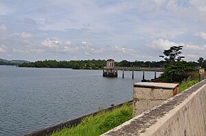
Caliraya lake
| Caliraya lake | ||
|---|---|---|

|
||
| Caliraya lake | ||
| Geographical location | Laguna Province , CALABARZON , Luzon , Philippines | |
| Tributaries | Caliraya (river) | |
| Drain | to the Laguna de Bay | |
| Places on the shore | Lumban , Cavinti , Kalayaan | |
| Data | ||
| Coordinates | 14 ° 17 '28 " N , 121 ° 30' 23" E | |
|
|
||
| Altitude above sea level | 365.85 m | |
| length | 8 kilometers | |
| width | 3 km | |
| scope | 30 km | |
| Maximum depth | 65 m | |
| Middle deep | 50 m | |
Lake Caliraya is an artificially created reservoir and is located in the Laguna Province , in the CALABARZON region of the Philippines . The lake is located in the southern Sierra Madre at an altitude of 365 meters above sea level. The Philippine capital Manila is about 110 km northwest of the lake and can be reached in around two and a half hours. Lake Caliraya is a popular destination for local and foreign tourists due to its cooler altitude, especially in the hot summer months.
The Caliraya Lake system, together with the Lumot Lake system, is part of a project to generate electricity in the Caliraya hydropower plant. The US Army engineering corps began construction of the dam on Lake Caliraya in the late 1930s. During the Second World War , the dam was the target of acts of sabotage by the guerrillas and could not be completed until 1953. Until the 1970s, the lake developed into an important local recreation area in the metropolitan region . In the 1980s, however, a significant economic decline set in when the Nuevo Ejército del Pueblo temporarily got the area around the lake under their control. Tourism has been recovering since the early 1990s.
