Capel Garmon
Coordinates: 53 ° 4 ′ 22.6 " N , 3 ° 45 ′ 56.5" W.
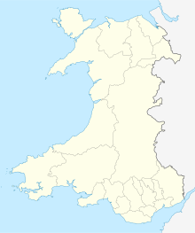
The megalithic site of Capel Garmon is located in the farmlands south-east of the village of Betws-y-Coed in Merionethshire in Wales . It is a hilly landscape with rock outcrops and swamps .
The facility, only one kilometer from the Afon (wal. For river) Conwy , has been restored. The shape of the worn cairn is marked on the ground. It shows certain parallels with the Cotswold-Severn tradition widespread in South Wales . In particular, the T-shaped chamber with lateral access in the hill is roughly identical to one of the chambers in Ty Isaf's complex , but the false door there is missing. The passage and the oval central and side chambers have largely been preserved. Today's access leads to the west chamber. It dates back to the 19th century when the facility was used as a stable. The original entrance is on the south side. Only a large capstone 4.3 m long remained above the western chamber. The facility had already been robbed when it was excavated in 1925. Only a flint chip and broken pottery were found. A small re-excavation provided evidence of activities prior to the construction of the cairn. One of these finds is a skull fragment.
Capel Garmon is a Scheduled Monument .
See also
literature
- Vicki Cummings, Alasdair Whittle: Places of special virtue - megaliths in the Neolithic landscapes of Wales , Oxbow, Oxford 2004, ISBN 1-84217-108-9
- Homer Sykes: Mysterious Britain - Fact and Folklore George Weidenfeld & Nicolson Ltd. 1993 ISBN 0-297-83196-8 p. 110
- Frances Lynch: Megalithic Tombs and Long Barrows in Britain . Shire, Princes Risborough 1997, ISBN 0-7478-0341-2 pp. 51-52 ( Shire archeology 73).


