Conwy (river)
|
Conwy Afon Conwy |
||
|
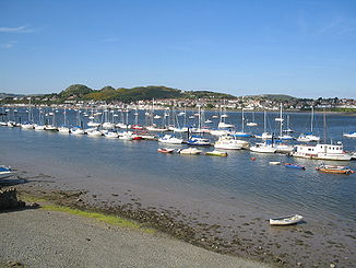
Boats on the Conwy |
||
| Data | ||
| location | North wales | |
| River system | Conwy | |
| River basin district | Western Wales | |
| source | Llyn Conwy 52 ° 59 ′ 43 " N , 3 ° 48 ′ 59" W. |
|
| Source height | 454 m | |
| muzzle | at Conwy in the Irish Sea Coordinates: 53 ° 17 ′ 54 ″ N , 3 ° 50 ′ 31 ″ W 53 ° 17 ′ 54 ″ N , 3 ° 50 ′ 31 ″ W |
|
| Mouth height | 0 m | |
| Height difference | 454 m | |
| Bottom slope | 11 ‰ | |
| length | 43 km | |
The Conwy ( Wal . : Afon Conwy ) is a river in northern Wales . The river is a little more than 27 miles from its source to its confluence with Conwy Bay in the Irish Sea .
The Conwy arises in the Migneint heather where a number of streams flow into the Llyn Conwy . It flows in a northerly direction where the Machno and Lledr rivers meet before the Conwy reaches Betws-y-Coed where the Afon Llugwy joins the river. It flows further north through Llanrwst and Trefriw before reaching Conwy on Conwy Bay. During the spring tide it is a tidal river up to Llanrwst.
Tributaries
Geology and geomorphology
In the east, mudstone hills from the Silurian mountains border the river, the Migneint-Heide. These stones, which are already acidic, are usually covered by a thin, acidic soil on which Mollina spp and Erica grasses grow. Due to its environment, the water in the upper reaches of the Conwy is often acidic and brown in color.
In the west, below the catchment area, there is harder rock from the Cambrian , so that the landscape is much steeper and more angular, with tall, isolated hills through which the river winds in cascades and waterfalls such as the Conwy Falls or the Lledr Gorge. The landscape is heavily forested with originally non-native conifers that were planted later.
The west side of the Conwy Valley is home to numerous lakes and reservoirs, some of which are used for drinking water. The rock there is rich in minerals , numerous former copper , lead and silver mines crisscross the landscape.
The central river valley down from Betws-y-Coed is comparatively fertile and suitable for livestock farming. Among other things, the pastures there serve as winter quarters for the sheep who spend the summer further up in the mountains.
Culture and history
Archaeological finds show that the Conwy Valley was already settled in the Stone Age. Since Roman times in Great Britain , the area has been continuously populated since around the year 400. The Conwy Valley has two of the oldest churches in Wales: Llanrhychwyn and Llangelynin , which date back to the 11th and 12th centuries.
During the Wars of the Roses , on the direction of Edward IV , the Earl of Pembroke devastated much of the Conwy Valley in revenge for an attack by the Lancasters on Denbigh in 1466.
At the mouth of the river in Conwy Bay lies the town of Conwy with the World Heritage Site Conwy Castle . Two famous bridges over the river: the Conwy Suspension Bridge , one of the oldest road chain bridges in the world designed by Thomas Telford , now has a pedestrian crossing, while Robert Stephenson's Conwy Railway Bridge still runs the railway line from Holyhead to London . A newer third bridge carries the road, the A55 runs in a new tunnel under the river mouth.
ecology
The Conwy is known for its salmon and brown trout stocks. Increasing acidification in the second half of the 20th century, especially in the upper course of the river, impaired their breeding success.
Remarks
This article is based on a translation of parts of the article River Conwy of the English Wikipedia in the version of March 21, 2007.
Web links
Individual evidence
- ↑ River Conwy ( English ) en.wikipedia.org. March 21, 2007.

