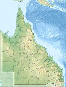
Capricorn Group
| Capricorn Group | ||
|---|---|---|
| Main island, Heron Island, with harbor and research station | ||
| Waters | Coral sea | |
| Geographical location | 23 ° 27 ′ S , 151 ° 55 ′ E | |
|
|
||
| Number of islands | 9 | |
| Main island | Heron Island | |
| Total land area | 2.495 km² | |
The Capricorn Group is one of the southernmost archipelago of the Great Barrier Reef off the Coral Sea coast of Queensland , Australia . Further south are only the Bunker Group , which appears like a southern continuation of the Capricorn Group, and Lady Elliott Island as the southernmost island of the Great Barrier Reef.
There are 16 coral reefs , nine or ten of which each have a cay (small and shallow coral island).
This does not include reefs such as Rock Cod Shoal , Irving Reef , Douglas Shoal , Haberfield Shoal , Guthrie Shoal and Innamincka Shoal , which are permanently around 10 to 20 meters under water and never dry out.
The islands vary widely in size, ranging from 4.5 hectares (North Reef Island) to 105 hectares (Northwest Island). The total area of all islands is around 250 hectares or 2.5 km².
The main island, and the third largest island in terms of area after Northwest Island and Masthead Island, is Heron Island , which has a research station, a holiday complex and a small harbor. Otherwise the islands are uninhabited, only the North Reef Lighthouse was manned until 1978.
The reefs and islands are part of the Capricornia Cays National Park .
The name of the archipelago (and the national park) goes back to the Tropic of Capricorn (23 ° 26'16 "S) - English Tropic of Capricorn - which runs through the group around 300 meters north of the main island of Heron Island.
Reefs and islands
![]() Map with all coordinates: OSM | WikiMap
Map with all coordinates: OSM | WikiMap
| reef | Shallowest depth (meters) |
Coordinates |
|---|---|---|
| Rock Cod Shoal | 7th | 23 ° 41 ′ 00.0 ″ S , 151 ° 37 ′ 00.0 ″ E |
| Irving Reef | 12 | 23 ° 33 ′ 01.0 ″ S , 151 ° 37 ′ 37.0 ″ E |
| Douglas Shoal | 8.2 | 23 ° 05 ′ 45.0 ″ S , 151 ° 38 ′ 20.0 ″ E |
| Haberfield Shoal | 9.8 | 23 ° 02 ′ 00.0 ″ S , 151 ° 47 ′ 00.0 ″ E |
| Guthrie Shoal | 9.4 | 23 ° 03 ′ 00.0 ″ S , 151 ° 51 ′ 00.0 ″ E |
| Innamincka Shoal | 9.4 | 23 ° 01 ′ 00.0 ″ S , 151 ° 51 ′ 00.0 ″ E |
Individual evidence
- ^ The study by JS Jell and PG Flood: Guide to the Geology of Reefs of the Capricorn and Bunker Groups, Great Barrier Reef Province. Papers, Department of Geology, University of Queensland, Volume 8, Number 3, April 1978 , does not list a cay with land on Broomfield Reef. There is no land area to be seen on the current satellite image either. However, Broomfield Cay is marked on a map .
- ↑ gbrmpa.gov.au ( Memento of the original from February 11, 2014 in the Internet Archive ) Info: The archive link was inserted automatically and has not yet been checked. Please check the original and archive link according to the instructions and then remove this notice. (pdf)

