Carewoodrig Burn
| Carewoodrig Burn | ||
|
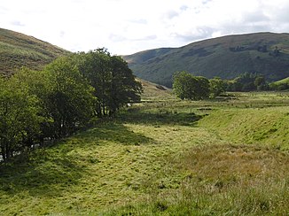
The Carewoodrig Burn valley with the watercourse on the left at the edge of the picture |
||
| Data | ||
| location | Dumfries and Galloway , Scotland | |
| River system | River Esk (Solway Firth) | |
| Drain over | Ewes Water → River Esk (Solway Firth) → Solway Firth → Irish Sea | |
| River basin district | Solway Tweed XRBD | |
| source | north of Geordie's Hill 55 ° 16 ′ 0 ″ N , 2 ° 53 ′ 11 ″ W |
|
| muzzle | Confluence with the Mosspaul Burn Coordinates: 55 ° 12 ′ 36 ″ N , 3 ° 6 ′ 22 ″ W 55 ° 12 ′ 36 ″ N , 3 ° 6 ′ 22 ″ W
|
|
| Left tributaries | Glendow Sike | |
| Right tributaries | Back Burn , Glenrief Burn | |
The Carewoodrig Burn is a watercourse in Dumfries and Galloway , Scotland . It is being built north of Geordie's Hill. It flows in a generally westerly direction until it at its confluence with the Mosspaul Burn the Ewes Water forms.
Web links
Commons : Carewoodrig Burn - collection of images, videos and audio files
