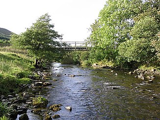
Ewes Water
| Ewes Water | ||
|
The Ewes Water |
||
| Data | ||
| location | Dumfries and Galloway , Scotland | |
| River system | River Esk (Solway Firth) | |
| Drain over | River Esk (Solway Firth) → Solway Firth → Irish Sea | |
| River basin district | Solway Tweed XRBD | |
| source | Confluence of Carewoodrig Burn and Mosspaul Burn 55 ° 15 ′ 8 ″ N , 2 ° 57 ′ 33 ″ W |
|
| muzzle | Muzzle into the River Esk Coordinates: 55 ° 9 ′ 12 ″ N , 3 ° 0 ′ 3 ″ W 55 ° 9 ′ 12 ″ N , 3 ° 0 ′ 3 ″ W
|
|
| Left tributaries | Unthank Burn , Mosspeeble Burn , Arkleton Burn , Glendivan Burn , Hoghill Burn , Terrona Burn | |
| Right tributaries | Meikledale Burn | |
The Ewes Water is a watercourse in Dumfries and Galloway , Scotland . It arises from the confluence of the Carewoodrig Burn and Mosspaul Burn south of Crude Hill . It flows south to its confluence with the River Esk in Langholm . The A7 road runs on the western side of the river from its formation to shortly before Langholm where it changes to the eastern side.
Web links
Commons : Ewes Water - collection of images, videos and audio files
