
Chaguaramas (Trinidad)
  | |
The State of Trinidad and Tobago ; Chaguaramas is the circled point on the island of Trinidad . |
Chaguaramas refers to the northwestern tip of the island of Trinidad and the surrounding islands.
Definition and location
Chaguaramas is an established term in Trinidad, but does not designate an officially limited area. Administratively, Chaguaramas belongs to the Diego Martin region . The area west of St. Peters Bay or Tucker Valley Road is commonly referred to as the Chaguaramas. The region covers about 60 square kilometers (6000 hectares). It is limited to the north by the Caribbean Sea and to the south by the Gulf of Paria . The Venezuelan mainland begins only approx. 25 km west of the offshore islands, the distance between the westernmost island Chacachacare and the easternmost Venezuelan island Isla de Patos is only 10 km.
history
The name Chaguaramas comes from the Arawak word for palm trees. In 1805 there was a slave revolt on the French sugar plantations in what is now Chaguaramas . In 1813 Chacachacare started one of the campaigns that led to Venezuela's renewed independence . In the late 19th century, Chaguaramas served as a base for whaling. From 1940 to 1963, the entire area was leased to the United States under the destroyer-for-base agreement , which established a naval base and a missile early warning system there. The fishing village of Carenage , located in Chaguaramas, was developed into an entertainment district for US soldiers at the time, but has only been a fishing village again since the Americans left. In 1958, twelve British colonies, including Trinidad and Tobago, founded the West Indian Federation and decided to establish the capital of the newly created state in the Chaguaramas area. Port of Spain became the temporary capital . The designated capital never got beyond the planning stage, as the West Indian Federation dissolved in 1962 after internal disputes. In 1973, the Treaty of Chaguaramas , through which the Caribbean Community (CARICOM) was founded, was signed here. Today Chaguaramas is the center of sailing in Trinidad, is home to numerous small marinas (e.g. the T&T Yacht Club in Glencoe) and serves as a starting point for sailing trips to the offshore islands such as the Bocas Islands or the Five Islands.
geography
On the peninsula there is one of the few dry forest stands in Trinidad. In 1961 the Chaguaramas National Park was established here.
towns and places
- Diego Martin (86,800 inhabitants, as of 2000)
- La Retraite
- Carenage
- Glencoe
Economy and institutions
In Chaguaramas there is a campus of the University of Trinidad and Tobago, which has a center for maritime studies. Defense Force FC, which plays in the first Trinidadian soccer league TT Pro League , is based in Chaguaramas, but plays its home games at Hasely Crawford Stadium in Port of Spain due to the lack of a suitable stadium .
The US company Alcoa operates a transshipment port for aluminum from Suriname near the city of Carenage , where 500,000 tons of aluminum are loaded annually for worldwide shipping.
gallery

Bamboo Cathedral

Five Islands
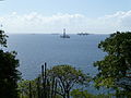
Drilling rig

Dry dock in Chaguaramas

Alcoa transshipment port


Web links
Individual evidence
- ↑ Description of Chaguaramas'
- ↑ Nalis.gov.tt: Chaguaramas. Retrieved December 17, 2015 .
- ↑ Chaguaramas Development Authority website: Chaguaramas History. Retrieved February 11, 2016 .
- ↑ Evelin Seeliger-Mander: Trinidad and Tobago. 3rd edition 2004, p. 223
- ↑ Dave DeWitt & Mary Jane Wilson: Callaloo, Calypso & Carnival, p. 4. The Crossing Press 1993
- ↑ Alcoa.com: Alcoa Signs Agreement in Principle to Build World-Class Aluminum Smelter in Trinidad and Tobago. Retrieved September 12, 2016 .
Coordinates: 10 ° 42 ′ 56 " N , 61 ° 34 ′ 42" W.