Checkerboard Mesa
| Checkerboard Mesa | ||
|---|---|---|
|
Checkerboard Mesa in Zion National Park |
||
| height | 2033 m | |
| location | Utah , USA | |
| Mountains | Zion Canyon | |
| Coordinates | 37 ° 13 '31 " N , 112 ° 52' 49" W | |
|
|
||
| Type | monolith | |
|
Checkerboard Mesa Canyon |
||
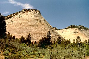
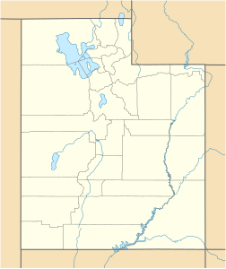
The Checkerboard Mesa (checkerboard table mountain) is a table mountain with a height of 2033 m and is located at the eastern entrance to Zion National Park in the US state of Utah . The mountain is one of the national park's attractions and is easily accessible via Utah State Route 9 (Zion-Mount-Carmel-Highway).
geology
The distinctive mountain consists of Navajo sandstone , the most important and widespread rock layer in the western United States. In the Zion Canyon it has its greatest thickness of over 700 meters, which is considered to be the thickest layer of sediment worldwide. The sandstone is extremely porous and is processed into a wide variety of shapes by the forces of nature. At the Checkerboard Mesa, vertical and horizontal furrows run through the surface of the mountain. The horizontal lines formed over time along the individual layers through erosion and weathering, while the vertical depressions can only be observed on the north side. Scientists have found that this phenomenon is caused by the slower melting of the snow and the drainage of water. Repeated thawing and re-freezing widened the furrows.
Checkerboard Mesa Canyon
Through the approximately two kilometer long Zion - Mount Carmel Tunnel , which was completed in 1930, you first reach the Overlook Trail on Utah Route 9 , which offers a spectacular view of the mountains around Zion Canyon. There are several parking spaces near the east exit of Zion National Park in front of the Checkerboard Mesa. The entrance to the canyon is west of the mountain on the highway and is easy to find. The trail runs from north to south in the drainage between Checkerboard Mesa in the east and Crazy Quilt Mesa in the west. The three-kilometer ascent to the mountain saddle at 2000 meters takes about 2 - 4 hours. From the highest point, the White Cliffs can be seen in the north and the surroundings of the Parunuweap Canyon in the distance . The way back is the same route.
Individual evidence
- ↑ Geology of Zion National Park (PDF; 26.6 MB), accessed on September 12, 2013
- ↑ Checkerboard Mesa , accessed September 12, 2013.


