Chincoteague (Virginia)
| Chincoteague | ||
|---|---|---|
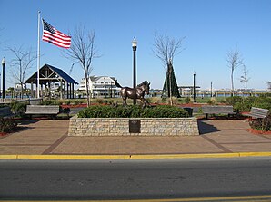
 Statue of Misty of Chincoteague |
||
 seal |
||
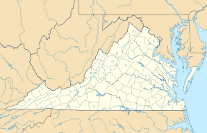
| Location in Virginia | ||
|
|
||
| Basic data | ||
| Foundation : | 1908 | |
| State : | United States | |
| State : | Virginia | |
| County : | Accomack County | |
| Coordinates : | 37 ° 56 ′ N , 75 ° 22 ′ W | |
| Time zone : | Eastern ( UTC − 5 / −4 ) | |
| Residents : | 2,941 (as of 2010) | |
| Population density : | 41.4 inhabitants per km 2 | |
| Area : | 96 km 2 (approx. 37 mi 2 ) of which 71.1 km 2 (approx. 27 mi 2 ) is land |
|
| Height : | 1 m | |
| Postal code : | 23336 | |
| Area code : | +1 757 | |
| FIPS : | 51-16512 | |
| GNIS ID : | 2390792 | |
| Website : | www.chincoteague-va.gov | |
| Mayor : | John H. Tarr | |
 Statue of a Chincoteague pony on the main street |
||
Chincoteague (IPA: / ˌʃɪŋkəˈtiːɡ / or / ˈʃɪŋkətiːɡ /) is an American town on Chincoteague Island in Accomack County , Virginia on the Delmarva Peninsula . Chincoteague is a loan word from the Algonquin languages .
The population was 2941 in 2010. The area of the village is 96.0 km². The Assateague ponies (Chincoteague ponies) that live on Assateague Island are named after the place . The island of Chincoteague Island has an area of 55.4 km².
Near the city was the Naval Auxiliary Air Station (NAAS) Chincoteague, part of which was the Naval Aviation Ordnance Test Station (NAOTS), on which various weapon systems and missiles were developed and tested.
Web links
Commons : Chincoteague Island (Virginia) - Collection of pictures, videos, and audio files
