Christophe Tassin
Christophe Tassin (* early 17th century in France ; † 1660 in France), also known as Nicolas Tassin , Christophe Nicolas Tassin or Christophe Le Tassin , was a French cartographer who worked in a series of atlases in regions in France, Spain, Germany and Switzerland has depicted. He appears to have published most of his first prints in Paris between 1633 and 1635. His publishers included Melchior Tavernier (1594–1665), Sébastien Cramoisy (1584–1669) and Michael van Lochum (1601–1647). As good as nothing has come down to us about his immediate circumstances.
Fields of activity
Around 1631 Christophe Tassin was appointed royal engineer and geographer (Ingenieur et Geographe du Roy). He was confronted with tasks that were ordered by high government agencies and were of great importance for military and political considerations. With this mandate he also received the right to publish his work for ten years, which he only seems to have exercised from 1633 to 1638. (His successor in this function was then the military cartographer and publisher Sébastien de Beaulieu [1612–1674].)

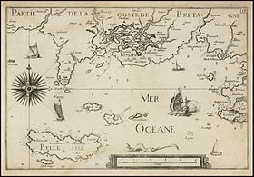
Christophe Tassin's first publications in 1633 were an atlas of the provinces of France and Spain (Cartes généralis des provinces de France et d'Espagne) , another of Germany (Cartes généralis des royaumes et provinces de la haute et basse Allemagna) and one of Lorraine (Plans et profils des principales villes du duché de Lorraine, avec les cartes generale et partuculieres de chacun gouvernement d'iucelles) . - In 1634 an atlas was published with plans and vedute of places and cities in France (Les plans et profils de toutes les principales villes et lieux considerables de France) and one about the coastal areas of the whole of France (Carte générale de toutes les costes de France ) . - In 1635 he published an atlas about Switzerland (Description de tovs les cantons, villes, bourgs, villages et av tres particularitzes du pays des Suisses) .
The publication of Lorraine in a separate volume had a current reference: In 1631 large parts of the province of Louis XIII. annexed and so there was a strong need for information for this region, which had to be met as quickly as possible. Perhaps this atlas (and its immediate approach) was arranged by Richelieu himself. The fact that Christophe Tassin must have come into personal contact with Richelieu can be seen from the fact that the atlas covering the coastal regions of France was dedicated to the cardinal.
In 1644 there was a turning point in Christophe Tassin's life: he finished his life's work and sold all of his copper plates to the cartographer and publisher Antoine de Fer (16 ..– 1673). (De Fer then released this copper under his name in many editions.) Why Christophe Tassin took this step is not known.
literature
- Wolfgang Reiniger: Beaulieu: The copper engravings on the campaigns of Ludwig XIV., In particular on those in Germany: Catalog , W. Reiniger, Bad Kreuznach 2000, ISBN 3-923714-06-8
- Fritz Hellwig, Wolfgang Reiniger, Klaus Stopp: Maps of the Palatinate on the Rhine 1513–1803: Catalog of the printed maps with an introduction to map history , W. Reiniger, Bad Kreuznach 1984, ISBN 3-923714-01-7
Web links
- Literature by and about Christophe Tassin in the bibliographic database WorldCat
- French National Library entries for Christophe Tassin
- Bayerische Staatsbibliothek Atlas with places and cities in France in an edition from 1638
- Bayerische Staatsbibliothek Atlas of Germany in the 1633 edition
| personal data | |
|---|---|
| SURNAME | Tassin, Christophe |
| ALTERNATIVE NAMES | Tassin, Nicolas; Tassin, Christophe Nicolas; Le Tassin, Christophe |
| BRIEF DESCRIPTION | French cartographer |
| DATE OF BIRTH | 17th century |
| PLACE OF BIRTH | France |
| DATE OF DEATH | 1660 |
| Place of death | France |
