Ciudad Mier
| Ciudad Mier | ||
|---|---|---|
|
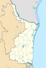
Coordinates: 26 ° 26 ′ N , 99 ° 9 ′ W Ciudad Mier on the map of Tamaulipas
|
||
| Basic data | ||
| Country | Mexico | |
| State | Tamaulipas | |
| Municipio | Mier | |
| City foundation | 1753 | |
| Residents | 4762 (2010) | |
| City insignia | ||
| Detailed data | ||
| height | 64 m | |
| San Jerónimo Church | ||
Ciudad Mier is a Mexican city in Tamaulipas on the border with the United States . The next place on the US side is McAllen . Ciudad Mier is the administrative seat of the Municipio Mier .
Several thousand people lived in Ciudad Mier by the end of 2010. The Los Zetas criminal cartel threatened the murder of all of the city's citizens, after which most of the residents fled.
Web links
- Municipio de mier tamaulipas. In: Official website of the municipality. Retrieved September 20, 2011 (Spanish).
Commons : Mier Municipality - Collection of images, videos, and audio files
Individual evidence
- ↑ a b Klaus Ehringfeld: Hundreds of thousands flee from Mafia violence. In: Frankfurter Rundschau . March 31, 2011, accessed April 1, 2011 .


