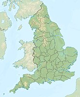
Cleveland Potash Mine
| Cleveland Potash Mine | |||
|---|---|---|---|
| General information about the mine | |||
| Daily facilities of the mine | |||
| Mining technology | Civil engineering | ||
| Funding / year | 3,600,000 t | ||
| Information about the mining company | |||
| Operating company | Cleveland Potash Ltd. | ||
| Employees | 800 (as of 2004) | ||
| Start of operation | 1968 | ||
| Funded raw materials | |||
| Degradation of | Halite / sylvinite | ||
| Halite / sylvinite | |||
| Boulby Potash Member | |||
| Mightiness | 7-20 | ||
| Raw material content | 34% | ||
| Greatest depth | 1500 m | ||
| Geographical location | |||
| Coordinates | 54 ° 33 '12.5 " N , 0 ° 49' 27.6" W | ||
|
|||
| Location | Boulby | ||
| Unitary Authority | Redcar and Cleveland | ||
| Country | United Kingdom | ||
| Cleveland Potash Ltd. | |
|---|---|
| legal form | Limited Company |
| Seat | Loftus, Saltburn by the Sea |
| Number of employees | around 800 (as of 2004) |
| sales | £ 94m (2004) |
| Branch | Mining |
| Website | Cleveland Potash Ltd. |
The Cleveland mine potash , as Boulby mine known, a potash - mine in Redcar and Cleveland , England, UK.
geography
Geographical location
The mine is located near Boulby on the North Sea coast of the North York Moors.
geology
The rock salt is at a depth of 1200 to 1500 meters . The Boulby-Potash-member seam has a maximum thickness of up to 20 meters; the average thickness is seven meters. It is easy from northwest to southeast one . The deposit was created in Upper Perm by evaporation from the Zechstein Sea . Boulby is located on the western edge of the Zechstein, which is mainly located under the North Sea and in continental Europe. Directly above the sylvinite is the halite , which also comes from the Zechstein and does not vary in thickness as much as the potash seam. In total, the Zechstein layers are around 150 meters thick at this point. Potassium chloride and halite layers probably formed in an extremely flat area in which a large salt lake was formed in the Permian.
history
Mining at Boulby dates back to before written records. The Boulby mine, however, was not started until the second half of the 20th century, 1969. The first salt was mined in 1973. The shafts were sunk using the freeze shaft method to stabilize the subsoil. In Boulby this technique was used down to a depth of 975 meters.
Mine
The mine, which is wholly owned by Israel Chemicals, is the only producer of potash fertilizer in the United Kingdom and, with a total production capacity of approximately 4.0 million tonnes per year (potash salt and rock salt), covers around 55% of the domestic demand. The mine extracts sylvinite as a raw material for the fertilizer industry and as a by-product rock salt , which is used regionally for use in winter gritting.
The track system of civil engineering mine extends underground for 15 km; around 850 employees mine around three million tons of potash and 0.6 million tons of rock salt annually (2004).
Day systems
The daytime facilities reveal little of the large underground expansion of the mine. Since they are in the middle of a national park, they should fit harmoniously into the landscape. They are made of locally available materials, the walls are made of natural stone and the roofs are made of slate. While the buildings mainly house ventilation systems, they should give the impression of a farm on the outside.
The two headframes of the shaft system have an unusual, cylindrical architecture.
Residues
Because of its location within the national park, Cleveland Potash did not get permission to stockpile the residue. This is why the processing residues, mainly clays, gypsum and salt, but also heavy metals such as cadmium and mercury , are flushed into the North Sea via a 1.8 km long pipeline.
Underground laboratory
Due to the great depth and the associated shielding against cosmic radiation , basic physical research makes use of the mine; various experiments are running in the Boulby Underground Laboratory . From 1987 to 2007 the UK Dark Matter Collaboration was located at a depth of 1,100 meters and was looking for WIMPs . Since this experiment was discontinued, the laboratory has been used for the large-scale experiments ZEPLIN-III and DRIFT-II .
Individual evidence
- ↑ a b c d e f g David Highley, Don Cameron, Deborah Rayner, Abigail Walters, Andrew Bloodworth: Mineral Planning Factsheet. (PDF, 645 kB) British Geological Survey, accessed on November 30, 2015 (English).
- ↑ Boulby, EskValley. (No longer available online.) In: eskvalley.com. Archived from the original on September 29, 2009 ; accessed on November 30, 2015 (English). Info: The archive link was inserted automatically and has not yet been checked. Please check the original and archive link according to the instructions and then remove this notice.
- ^ PJ Brenchley, Peter Franklin Rawson: The geology of England and Wales . Ed .: Geological Society. Geological Society, London / Williston, VT 2006, ISBN 1-86239-200-5 , pp. 289 .
- ↑ John S. Harris: Ground freezing in practice . Thomas Telford, London / New York, NY 1995, ISBN 0-7277-1995-5 , pp. 7 .
- ^ Tom Turner: Landscape planning and environmental impact design . Routledge, 1998, ISBN 1-85728-322-8 , pp. 196 .
- ↑ Donald E. Garrett: Potash: deposits, processing, properties, and uses (restricted preview: books.google.de )
Web links
- GEO ExPro - Fertilizing the Future. In: geoexpro.com. Retrieved November 30, 2015 .


