Conceição (Paraíba)
| Conceição | |
|---|---|
|
Coordinates: 7 ° 34 ′ S , 38 ° 33 ′ W
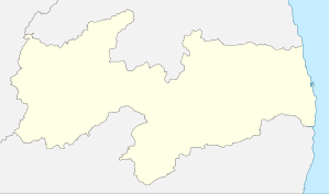
Conceição on the map of Paraíba
|
|
|
Location of the municipality of Conceição in the state of Paraíba
|
|
| Basic data | |
| Country | Brazil |
| Federal District |
|
| City foundation | 1881 |
| Residents | 18,363 (IBGE / 2010) |
| City insignia | |
| Detailed data | |
| surface | 579.436 km² |
| Population density | 31.69 inhabitants / km 2 |
| height | 376 m |
| Time zone | UTC −3 |
Conceição , officially Município de Conceição , is a municipality in the Brazilian state of Paraíba . In 2019, around 18,982 people lived here.
Districts
- Centro
- São José
- Nossa de Fátima
- São Geraldo
- Novo Horizonte
Sons and daughters of the church
- José de Lima Siqueira (1907–1985), conductor and composer
- Elba Ramalho (* 1951), musician
Web links
Commons : Conceição - collection of images, videos and audio files
- City Prefecture website , Prefeitura Municipal (Portuguese)
- City Council website , Câmara Municipal (Portuguese)
- Conceição on the website of the Federação dos Municípios da Paraíba , brief information (Portuguese)
- Dados municipais e mapa de alta resolução em PDF
- IBGE : Cidades @ Paraíba: Conceição. Retrieved August 28, 2019 (Brazilian Portuguese).


