Cook Glacier (Kerguelen)
| Cook glacier | ||
|---|---|---|
|
Southern edge of the glacier |
||
| location | Kerguelen | |
| Type | icecap | |
| length | 27 km | |
| surface | 403 km² | |
| Altitude range | 1049 m - 0 m | |
| width | Max. 23 km | |
| Coordinates | 49 ° 19 ′ S , 69 ° 3 ′ E | |
|
|
||
| particularities | largest glacier on French territory | |
|
Satellite image of the Kerguelen Archipelago with the Cook Glacier |
||
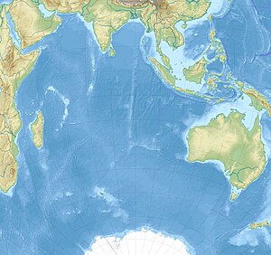
The Cook Glacier ( French Glacier Cook or Calotte glaciaire Cook ) is the largest ice cap of about France belonging Kerguelen -Archipels in the southern Indian Ocean and the largest glacier on French territory. It is located in the far west of the main island Grande Terre and covers an area of around 403 km². The highest point of the glacier, called Le Dôme , is 1049 m above sea level. The glacier is named after James Cook , who explored the archipelago on his third South Sea voyage in 1776.
The glacier has retreated significantly over the past few decades. From 1967 to 2003, the ice cap lost 20% of its area and 22% of its volume. The main reason for the retreat of the glacier is considered to be the significantly reduced annual rainfall.
literature
- Etienne Berthier et al .: Ice wastage on the Kerguelen Islands (49 ° S, 69 ° E) between 1963 and 2006 . In: Journal of Geophysical Research . tape 114 , F3, July 23, 2009, doi : 10.1029 / 2008JF001192 (English).
Individual evidence
- ↑ a b c La fonte spectaculaire du plus gros glacier français. Press release. In: Environnement - Actualités - Cryosphère. Institut national des sciences de l'univers (INSU), Center national de la recherche scientifique (CNRS), July 21, 2009, accessed on May 15, 2017 (French).
- ↑ a b Îles Kerguelen. Topographic map 1: 200,000. In: Géoportail. Institut national de l'information geographique et forestière (IGN), accessed on May 15, 2017 (French).
- ↑ Deborah Verfaillie, Vincent Favier, Marie Dumont, Vincent Jomelli, Adrien Gilbert, Daniel Brunstein, Hubert Gallée, Vincent Rinterknecht, Martin Menegoz, Yves Frenot: Recent glacier decline in the Kerguelen Islands (49 ° S, 69 ° E) derived from modeling , field observations, and satellite data (PDF; 4.90 MB). In: Journal of Geophysical Research: Earth Surface . Volume 120, 2015, pp. 637-654 (English), doi : 10.1002 / 2014JF003329


