Coquille (Revinson)
| Coquille | ||
|
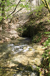
The Coquille about 25 m below its source |
||
| Data | ||
| Water code | FR : F0020600 | |
| location | France , Bourgogne-Franche-Comte region | |
| River system | His | |
| Drain over | Revinson → Seine → English Channel | |
| source | northeast of Étalante 47 ° 38 ′ 42 " N , 4 ° 45 ′ 57" E |
|
| Source height | approx. 379 m | |
| muzzle | west of Beaunotte in the Revinson Coordinates: 47 ° 40 ′ 29 " N , 4 ° 41 ′ 5" E 47 ° 40 ′ 29 " N , 4 ° 41 ′ 5" E |
|
| Mouth height | approx. 293 m | |
| Height difference | approx. 86 m | |
| Bottom slope | approx. 9 ‰ | |
| length | 9.6 km | |
The Coquille is a small river in France that runs in the Côte-d'Or department in the Bourgogne-Franche-Comté region .
geography
The Coquille rises from a karst spring northeast of Étalante in the valley called Cirque de la Coquille . The spring is surrounded by limestone cliffs in a semicircle. The Coquille flows through the town, to the west of it after about one kilometer, the Prelard , which is already about 6 km long, takes up as a left tributary and runs northwest parallel to the Départementsstraße 101 to Aignay-le-Duc . From there, the Coquille flows along Départementsstrasse 901 through Beaunotte and flows as a right tributary into the Revinson , which flows into the Seine about a kilometer west of it.
Tributaries
- Prelard (left)
- Ruisseau de Banlot (right)

