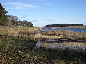
Crosswood Reservoir
| Crosswood Reservoir | |||||||||
|---|---|---|---|---|---|---|---|---|---|
| Crosswood Reservoir | |||||||||
|
|||||||||
|
|
|||||||||
| Coordinates | 55 ° 48 '6 " N , 3 ° 30' 8" W | ||||||||
| Data on the structure | |||||||||
| Data on the reservoir | |||||||||
| Water surface | 29 hectares | ||||||||
| Reservoir length | 640 m | ||||||||
| Reservoir width | 420 m | ||||||||
The Crosswood Reservoir is a reservoir in Scotland . On the west side the lake ends with an earth wall. The reservoir operated by Scottish Water is used to supply drinking water.
geography
The approximately 640 m long and maximum 420 m wide lake is located in the southeast of the Council Area West Lothian on the western flank of Torweaving Hill, which belongs to the Pentland Hills . It occupies an area of 29 hectares . The small town of Livingston is around eight kilometers to the north . With the Harperrig Reservoir and the Cobbinshaw Reservoir, there are two other reservoirs in the immediate vicinity.
The lake dams the water of the Crosswood Burns, which rises on the slopes of Craigengar . The Crosswood Burn, which flows off on the west side, joins after a few kilometers to the Camilty Burn , which finally drains into Linhouse Water . The Linhouse Water is one of the main tributaries of the Almond , which flows into the Firth of Forth .
Individual evidence
Web links
- Entry on Crosswood Reservoir in Canmore, Historic Environment Scotland database


