
Craigengar
| Craigengar | ||
|---|---|---|
 East flank of the Craigengar |
||
| height | 519 m ASL | |
| location | Scottish Borders , West Lothian , Scotland | |
| Mountains | Pentland Hills | |
| Coordinates | 55 ° 46 '50 " N , 3 ° 27' 8" W | |
|
||

The Craigengar is a hill in the Pentland Hills . The 519 m high elevation lies in its center in the southern part of the approximately 25 km long chain of hills. The border between the Scottish Council Areas Scottish Borders and West Lothian runs over the knoll .
The closest town is Tarbrax, about six kilometers to the west . West Linton is seven kilometers southeast of the eastern flank of the Pentland Hills. The surrounding hills include the Mealowther in the northwest, Colzium Hill in the north, Byrehope Mount in the east, Catstone Hill in the south and the Millstone Rig in the southwest.
Surroundings
Several streams arise on the flanks of the Craigengar. A brook flowing down from the eastern flank is one of the tributaries of the West Water Reservoir , which was established in 1969 and serves as the regional water supply. A stream flows off the south flank and flows into Medwin Water , which first marks the border between West Lothian and South Lanarkshire , then between South Lanarkshire and the Scottish Borders before it widens to South Medwin . The Crosswood Burn rises on the northeast flank and is dammed up on the western flank of the Pentland Hills to form the Crosswood Reservoir . The reservoir is used to supply water to the West Lothian and Edinburgh regions .
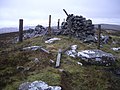
Cairn on the hilltop

Crosswood Burn


Individual evidence
- ^ Entry in the Gazetteer for Scotland
- ^ Entry in the Gazetteer for Scotland
- ^ Entry in the Gazetteer for Scotland