Mealowther
| Mealowther | ||
|---|---|---|
|
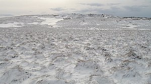
Mealowther in winter |
||
| height | 444 m ASL | |
| location | West Lothian , Scotland | |
| Mountains | Pentland Hills | |
| Coordinates | 55 ° 47 '18 " N , 3 ° 28' 14" W | |
|
|
||
The Mealowther is a hill in the Pentland Hills . The 444 m high elevation lies on the west flank in the center of the approximately 25 km long range of hills in the southeast of the Scottish Council Area West Lothian .
The nearest town is West Linton, eight kilometers to the southeast . West Calder is nine kilometers northwest. The surrounding hills include Colzium Hill in the northeast, Craigengar and Millstone Rig in the southeast, White Craig and Henshaw Hill in the southwest, and Torweaving Hill in the northwest.
Surroundings
There are three cairns on the southwest slopes of Mealowther and Torweaving Hill . All three were disturbed. They measure 25, 8 and 5 m in diameter with heights of 0.2, 0.5 and 0.3 m. In addition to the Cairns, stones with cup-and-ring markings were also found in this area .
Finds of Roman coins have been recorded in the same area. They could be related to the small Roman fort known as Castle Greg about three kilometers to the northwest.
The Crosswood Burn rises between Mealowther and Craigengar . It describes a semicircle around the hill and is dammed northwest of the Torweaving Hills to the Crosswood Reservoir . This is used to supply drinking water in the Central Belt . The West Burn , which rises on the north flank, feeds the Harperrig Reservoir to the north . Established in 1860, the reservoir dams the water of the Water of Leith and serves both to supply Edinburgh with water and to regulate the flow of the Water of Leith.
Individual evidence
- ^ Entry in the Gazetteer for Scotland
- ↑ Entry on Crosswood in Canmore, the database of Historic Environment Scotland (English)
- ↑ Entry on Crosswood in Canmore, the database of Historic Environment Scotland (English)
- ↑ Entry on Crosswood in Canmore, the database of Historic Environment Scotland (English)
- ↑ Entry on Crosswood in Canmore, the database of Historic Environment Scotland (English)
- ↑ Entry on Crosswood Burn in Canmore, the database of Historic Environment Scotland (English)
- ↑ Entry on Castle Greg in Canmore, the database of Historic Environment Scotland (English)
- ^ Entry in the Gazetteer for Scotland
- ^ Information in the Gazetteer for Scotland
- ^ Entry in the Gazetteer for Scotland

