Henshaw Hill
| Henshaw Hill | ||
|---|---|---|
|
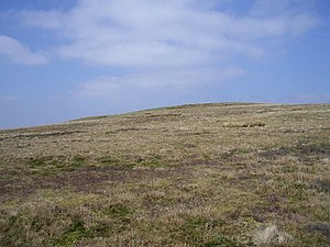
The east flank of the Henshaw Hills |
||
| height | 416 m ASL | |
| location | West Lothian , South Lanarkshire , Scotland | |
| Mountains | Pentland Hills | |
| Coordinates | 55 ° 46 '33 " N , 3 ° 29' 59" W | |
|
|
||
The Henshaw Hill is a hill in the Pentland Hills . The 416 m high elevation lies on its western flank in the south of the 25 km long chain of hills. The border between the Scottish Council Areas West Lothian in the north and South Lanarkshire in the south runs over the hilltop .
The nearest town is Tarbrax, around three kilometers to the west . West Linton is nine kilometers east-southeast of the eastern flank of the range of hills. The surrounding hills include the Mealowther in the northwest, White Craig and Millstone Rig in the northeast, Bores Rig in the east, Bleak Law in the southeast, and Harrows Law and Black Birn in the south and southwest, respectively.
Surroundings
Various streams have their source on the slopes of the Henshaw Hills. A tributary of the Crosswood Burn flows from the north flank , which is dammed around 2.5 m north to the Crosswood Reservoir . This is used to supply drinking water in the Central Belt . The Medwin Water , which rises on the east flank , initially marks the border between West Lothian and South Lanarkshire. From the valley between Millstone Rig and White Craig, it forms the border between South Lanarkshire and the Scottish Borders .

