Pentland Hills
| Pentland Hills | ||
|---|---|---|
|
View from Mauldslie Hill ( Moorfoot Hills ) of the northeast flank of the Pentland Hills |
||
| Highest peak | Scald Law ( 579 m ASL ) | |
| location | Scotland | |
|
|
||
| Coordinates | 55 ° 50 ′ N , 3 ° 20 ′ W | |
| Age of the rock | approx. 400 million years | |
The Pentland Hills , also short Pentlands , are a range of hills in Scotland . It extends over a length of 25 km from the southern foothills of Edinburgh in the northeast to the hamlets of Newbigging and Dunsyre in the southwest. Administratively, the Pentland Hills thus extend over five Council Areas : Edinburgh, West Lothian , South Lanarkshire , Midlothian and Scottish Borders , with Midlothian accounting for the largest area.
description
The range of hills consists largely of sandstone , the age of which is estimated to be around 400 million years. There are also volcanic rocks from the Devonian era . The Pentland Hills are characterized by numerous wide valleys and deep gullies , so that there is no continuous ridge . The most significant cuts include the Logan Burns Valley in the northeast and the Cauldstane Slap Pass in the center of the Pentland Hills. In the south, several individual hills connect the chain with the Southern Uplands .
Summit in the Pentlands
| Surname | height | Council Area | image |
|---|---|---|---|
| Scald Law | 579 m | Midlothian |
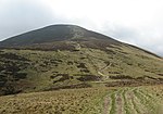
|
| Carnethy Hill | 573 m | Midlothian |
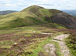
|
| East Cairn Hill | 567 m | West Lothian / Edinburgh / Scottish Borders |

|
| South Black Hill | 563 m | Midlothian |
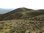
|
| West Cairn Hill | 562 m | West Lothian / Scottish Borders |

|
| West Kip | 551 m | Midlothian |

|
| Byrehope mount | 536 m | Scottish Borders |
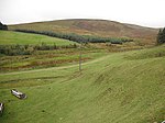
|
| Mount Maw | 535 m | Scottish Borders |

|
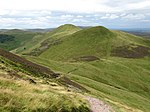
| East Kip | 534 m | Midlothian |
|
| Grain heads | 532 m | Scottish Borders |

|
| Spittal Hill | 526 m | Midlothian |

|
| Green Law | 525 m | Midlothian |

|
| Craigengar | 519 m | Scottish Borders / West Lothian |

|
| Wether Law | 519 m | Scottish Borders | |
| Turnhouse Hill | 506 m | Midlothian |

|
| Black Hill | 501 m | Midlothian |
|
| Cap Law | 497 m | Midlothian |

|
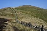
| Allermuir Hill | 493 m | Edinburgh / Midlothian |
|
| Castlelaw Hill | 488 m | Midlothian |

|
| Cock rig | 479 m | Midlothian |

|
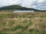
| Caerketton Hill | 478 m | Edinburgh / Midlothian |
|
| Colzium Hill | 477 m | West Lothian | |
| Patie's Hill | 475 m | Midlothian |

|
| King Seat | 463 m | Scottish Borders | |
| Capelaw Hill | 454 m | Edinburgh |

|
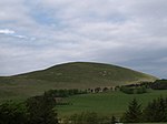
| Mendick Hill | 451 m | Scottish Borders |
|
| Hare Hill | 449 m | Midlothian |
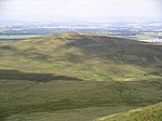
|
| Catstone Hill | 448 m | Scottish Borders |
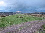
|
| Loanes rig | 448 m | South Lanarkshire |
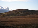
|
| Bleak Law | 445 m | South Lanarkshire |

|
| Mealowther | 444 m | West Lothian |

|
| Millstone Rig | 439 m | Scottish Borders | |
| Braid Law | 436 m | Midlothian |

|
| White Craig | 434 m | South Lanarkshire |

|
| Harbor Hill | 421 m | Midlothian |
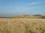
|
| Faw Mount | 416 m | Scottish Borders |

|
| Henshaw Hill | 416 m | West Lothian / South Lanarkshire |

|
| Harrows Law | 414 m | South Lanarkshire |

|
| Bell's Hill | 406 m | Midlothian |

|
| Torweaving Hill | 403 m | West Lothian |

|
| Dunsyre Hill | 401 m | South Lanarkshire |

|
| Woodhouselee Hill | 383 m | Midlothian |

|
| Black pear | 370 m | South Lanarkshire | |
| Left Law | 360 m | South Lanarkshire |
Waters
Numerous streams have their source in the Pentland Hills. They essentially drain over the North Esk (along the east flank), the Water of Leith (along the west flank) and the Clyde in the south. As early as the 19th century, reservoirs were created in the Pentland Hills to supply the Edinburgh metropolitan area with water . Torduff , Clubbiedean and Bonaly Reservoir are in the north not far from Edinburgh. The Loganlea and the Glencorse Reservoir are located at the level of Penicuik and draining over the Glencorse Burn (to the North Esk) . Both the Threipmuir and the Harlaw Reservoir flow westward into the Water of Leith. There is also the North Esk Reservoir , which was used to regulate the runoff of the North Esk, where numerous water-powered mills were located. The Crosswood Reservoir , which drains into the Almond via the Linhouse Water, is used to supply drinking water.
Individual evidence
- ↑ a b Entry in the Gazetteer for Scotland
- ↑ a b c d e Pentland Hills , in: FH Groome: Ordnance Gazetteer of Scotland: A Survey of Scottish Topography, Statistical, Biographical and Historical. Grange Publishing, Edinburgh, 1885.
- ^ Entry in the Gazetteer for Scotland
- ^ Entry in the Gazetteer for Scotland
- ^ Entry in the Gazetteer for Scotland
- ^ Entry in the Gazetteer for Scotland
- ^ Entry in the Gazetteer for Scotland
- ^ Entry in the Gazetteer for Scotland
- ^ Entry in the Gazetteer for Scotland
- ^ Entry in the Gazetteer for Scotland
- ^ Entry in the Gazetteer for Scotland
- ^ Entry in the Gazetteer for Scotland
- ^ Entry in the Gazetteer for Scotland
- ^ Entry in the Gazetteer for Scotland
- ^ Entry in the Gazetteer for Scotland
- ^ Entry in the Gazetteer for Scotland
- ^ Entry in the Gazetteer for Scotland
- ^ Entry in the Gazetteer for Scotland
- ^ Entry in the Gazetteer for Scotland
- ^ Entry in the Gazetteer for Scotland
- ^ Entry in the Gazetteer for Scotland
- ^ Entry in the Gazetteer for Scotland
- ^ Entry in the Gazetteer for Scotland
- ^ Entry in the Gazetteer for Scotland
- ^ Entry in the Gazetteer for Scotland
- ^ Entry in the Gazetteer for Scotland
- ^ Entry in the Gazetteer for Scotland
- ^ Entry in the Gazetteer for Scotland
- ^ Entry in the Gazetteer for Scotland
- ^ Entry in the Gazetteer for Scotland
- ^ Entry in the Gazetteer for Scotland
- ^ Entry in the Gazetteer for Scotland
- ^ Entry in the Gazetteer for Scotland
- ^ Entry in the Gazetteer for Scotland
- ^ Entry in the Gazetteer for Scotland
- ^ Entry in the Gazetteer for Scotland
- ^ Entry in the Gazetteer for Scotland
- ^ Entry in the Gazetteer for Scotland
- ^ Entry in the Gazetteer for Scotland
- ^ Entry in the Gazetteer for Scotland
- ^ Entry in the Gazetteer for Scotland
- ^ Entry in the Gazetteer for Scotland
- ^ Entry in the Gazetteer for Scotland


