Moorfoot Hills

from Wikipedia, the free encyclopedia
Moorfoot Hills
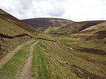
View of the southwest flank of the Moorfoot Hills

View of the southwest flank of the Moorfoot Hills

Highest peak Windlestraw Law ( 659  m ASL )
location Scotland
Moorfoot Hills (Scotland)
Moorfoot Hills
Coordinates 55 ° 42 ′  N , 3 ° 2 ′  W Coordinates: 55 ° 42 ′  N , 3 ° 2 ′  W
Age of the rock approx. 420 million years
p1

The Moorfoot Hills are a hilly area of ​​the Southern Uplands in Scotland . They extend for about 20 km between Peebles in the southwest and Tynehead in the northeast. Administratively, the Moorfoot Hills are essentially in the Scottish Borders , but the peaks along the northwest flank mark the border with Midlothian . Historically, this is where the border between Edinburghshire and Peeblesshire ran . The Moorfoot Hills lie between the Pentland Hills in the west and the Lammermuir Hills in the northeast.

description

The hilly area originated in the late Silurian , about 420 million years ago. To the west the valley of Eddleston Water , to the east that of Gala Water limits the hill area. Both rivers flow into the Tweed , which runs along the southern flank. The group of hills consists of separated or grouped, mostly grassy hills without a continuous ridge . The highest point is the 659 m high Windlestraw Law .

Summit of the Moorfoot Hills

Surname height Council Area image
Windlestraw Law
55 ° 40 ′ 38.6 "  N , 3 ° 0 ′ 7.1"  W.
659 m Scottish Borders Windlestraw Law
Bareback Knowe
55 ° 40 ′ 4.2 ″  N , 3 ° 0 ′ 55.6 ″  W.
656 m Scottish Borders Bareback knowe
Blackhope Scar
55 ° 43 ′ 24.1 ″  N , 3 ° 5 ′ 31.1 ″  W.
651 m Scottish Borders / Midlothian Windlestraw Law
Bowbeat Hill
55 ° 42 ′ 37.5 "  N , 3 ° 7 ′ 37.4"  W.
626 m Scottish Borders / Midlothian Bowbeat Hill
Whitehope Law
55 ° 41 '22.9 "  N , 3 ° 3' 58.9"  W.
623 m Scottish Borders Whitehope Law
Dundreich 55 ° 43 '47
.2 "  N , 3 ° 9' 23.6"  W.
622 m Scottish Borders Dundreich
Emly Bank
55 ° 42 ′ 53.5 "  N , 3 ° 7 ′ 13.6"  W.
605 m Scottish Borders / Midlothian
Dunslair Heights 55 ° 40 '50 .7
N , 3 ° 8' 4.3"  W.
602 m Scottish Borders Dunslair Heights
Totto Hill
55 ° 41 ′ 44.6 "  N , 3 ° 5 ′ 57.8"  W.
601 m Scottish Borders Totto Hill
Eastside Heights
55 ° 42 ′ 8 ″  N , 3 ° 1 ′ 37 ″  W.
593 m Scottish Borders Eastside Heights
Cardon Law
55 ° 41 ′ 54.5 "  N , 3 ° 8 ′ 57.8"  W.
588 m Scottish Borders Cardon Law
Makeness Kipps
55 ° 41 ′ 19.3 ″  N , 3 ° 8 ′ 37.2 ″  W.
583 m Scottish Borders Makeness Kipps
Scawd Law
55 ° 39 ′ 13.2 "  N , 3 ° 0 ′ 22.1"  W.
549 m Scottish Borders Scawd Law
Priesthope Hill
55 ° 38 '55.8 "  N , 3 ° 2' 0.2"  W.
543 m Scottish Borders Priesthope Hill
Seathope Law
55 ° 39 ′ 8.2 "  N , 2 ° 58 ′ 41.9"  W.
542 m Scottish Borders Seathope Law
Rawburn Head
55 ° 43 ′ 8 "  N , 2 ° 59 ′ 34"  W.
542 m Scottish Borders Rawburn Head
The Kipps
55 ° 44 ′ 19 ″  N , 3 ° 6 ′ 30.6 ″  W.
542 m Midlothian The Kipps
Clog Knowe
55 ° 39 ′ 58.1 ″  N , 3 ° 5 ′ 42.5 ″  W.
541 m Scottish Borders Clog Knowe
Black Law
55 ° 40 ′ 2.6 ″  N , 3 ° 6 ′ 3.7 ″  W.
538 m Scottish Borders Black Law
Huntly Cot Hill
55 ° 44 ′ 44.7 "  N , 3 ° 5 ′ 40.4"  W.
531 m Midlothian Huntly Cot Hill (right)
Black Knowe
55 ° 39 ′ 27.8 ″  N , 3 ° 5 ′ 12 ″  W.
522 m Scottish Borders Black Knowe
Mauldslie Hill
55 ° 45 ′ 16 "  N , 3 ° 4 ′ 56"  W.
513 m Scottish Borders / Midlothian Mauldslie Hill
Yardstone Knowe
55 ° 40 ′ 12.4 "  N , 2 ° 55 ′ 53.8"  W.
513 m Scottish Borders Yardstone Knowe
Garvald Law
55 ° 44 ′ 16 ″  N , 3 ° 3 ′ 0 ″  W.
512 m Scottish Borders Garvald Law
Great Law
55 ° 39 ′ 42.5 "  N , 2 ° 56 ′ 28.7"  W.
509 m Scottish Borders
Dunlee Hill
55 ° 40 ′ 32.9 "  N , 2 ° 56 ′ 22"  W.
505 m Scottish Borders Dunlee Hill
Stony Knowe
55 ° 38 ′ 43.3 "  N , 2 ° 57 ′ 49.7"  W.
505 m Scottish Borders Stony Knowe
Lee Pen
55 ° 38 '10.7 "  N , 3 ° 4' 20"  W.
502 m Scottish Borders Lee Pen
Maiden Law
55 ° 39 ′ 40.2 "  N , 2 ° 58 ′ 6.4"  W.
502 m Scottish Borders Maiden Law
Ferniehirst Hill
55 ° 40 ′ 4 ″  N , 2 ° 54 ′ 54 ″  W.
501 m Scottish Borders Ferniehirst Hill
Dod Law
55 ° 44 ′ 53.2 "  N , 2 ° 59 ′ 50.6"  W.
473 m Scottish Borders Dod Law
Torfichen Hill
55 ° 45 ′ 46.8 ″  N , 3 ° 3 ′ 36 ″  W.
460 m Scottish Borders / Midlothian Peaty Hill
Broad Law
55 ° 46 ′ 21.2 "  N , 3 ° 2 ′ 52.4"  W.
450 m Scottish Borders / Midlothian Broad Law
The Struther
55 ° 43 '5 "  N , 2 ° 57' 28"  W.
438 m Scottish Borders
Hog Hill
55 ° 44 ′ 49.4 "  N , 3 ° 8 ′ 56.9"  W.
434 m Midlothian Hog Hill (right)
Dod Hill
55 ° 40 ′ 10.6 "  N , 3 ° 3 ′ 30.2"  W.
433 m Scottish Borders Dod Hill
Carcant Hill
55 ° 45 ′ 47 "  N , 3 ° 0 ′ 14.6"  W.
425 m Scottish Borders Carcant Hill
Watherston Hill
55 ° 42 ′ 32 "  N , 2 ° 55 ′ 10"  W.
414 m Scottish Borders Kirn Law
Kirn Law
55 ° 39 '24.6 "  N , 3 ° 7' 27.8"  W.
412 m Scottish Borders Kirn Law
Ruther Law
55 ° 47 ′ 21.8 "  N , 3 ° 0 ′ 11"  W.
383 m Scottish Borders / Midlothian Ruther Law
Bowshank Hill
55 ° 39 ′ 10 "  N , 2 ° 53 ′ 55.3"  W.
379 m Scottish Borders
Knowes Hill
55 ° 38 ′ 6.6 "  N , 2 ° 53 ′ 43.2"  W.
374 m Scottish Borders Knowes Hill
Hog Hill
55 ° 42 ′ 34.1 "  N , 3 ° 11 ′ 11.4"  W.
350 m Scottish Borders
Ven Law
55 ° 39 '25.4 "  N , 3 ° 10' 47.5"  W.
325 m Scottish Borders Ven Law
Castle Hill
55 ° 38 ′ 56.7 ″  N , 3 ° 7 ′ 36.2 ″  W.
324 m Scottish Borders Castle Hill

Individual evidence

  1. a b Entry in the Gazetteer for Scotland
  2. ^ Moorfoot in: FH Groome (Ed.): Ordnance Gazetteer of Scotland: A Survey of Scottish Topography, Statistical, Biographical and Historical , Grange Publishing Works, Edinburgh, 1882–1885.
  3. ^ Entry in the Gazetteer for Scotland
  4. Entry on themountainguide.co.uk
  5. ^ Entry in the Gazetteer for Scotland
  6. Entry on themountainguide.co.uk
  7. ^ Entry in the Gazetteer for Scotland
  8. ^ Entry in the Gazetteer for Scotland
  9. ^ Entry in the Gazetteer for Scotland
  10. ^ Entry in the Gazetteer for Scotland
  11. ^ Entry in the Gazetteer for Scotland
  12. Entry on themountainguide.co.uk
  13. ^ Entry in the Gazetteer for Scotland
  14. ^ Entry in the Gazetteer for Scotland
  15. Entry on themountainguide.co.uk
  16. Entry on themountainguide.co.uk
  17. Entry on themountainguide.co.uk
  18. Entry on themountainguide.co.uk
  19. ^ Entry in the Gazetteer for Scotland
  20. ^ Entry in the Gazetteer for Scotland
  21. ^ Entry in the Gazetteer for Scotland
  22. Entry on themountainguide.co.uk
  23. ^ Entry in the Gazetteer for Scotland
  24. ^ Entry in the Gazetteer for Scotland
  25. ^ Entry in the Gazetteer for Scotland
  26. Entry on themountainguide.co.uk
  27. ^ Entry in the Gazetteer for Scotland
  28. ^ Entry in the Gazetteer for Scotland
  29. Entry on themountainguide.co.uk
  30. ^ Entry in the Gazetteer for Scotland
  31. Entry on themountainguide.co.uk
  32. ^ Entry in the Gazetteer for Scotland
  33. Entry on themountainguide.co.uk
  34. ^ Entry in the Gazetteer for Scotland
  35. ^ Entry in the Gazetteer for Scotland
  36. Entry on themountainguide.co.uk
  37. ^ Entry in the Gazetteer for Scotland
  38. ^ Entry in the Gazetteer for Scotland
  39. Entry on themountainguide.co.uk
  40. Entry on themountainguide.co.uk
  41. Entry on themountainguide.co.uk
  42. ^ Entry in the Gazetteer for Scotland
  43. Entry on themountainguide.co.uk
  44. Entry on themountainguide.co.uk
  45. ^ Entry in the Gazetteer for Scotland
  46. ^ Entry in the Gazetteer for Scotland
  47. ^ Entry in the Gazetteer for Scotland

Web links

Commons : Moorfoot Hills  - Collection of Images, Videos and Audio Files