
Midlothian
|
Midlothian Meadhan Lodainn |
|
|---|---|
  |
|
| Administrative headquarters | Dalkeith |
| surface | 354 km² (21.) |
| Population (2012) | 84,240 (27.) |
| ISO 3166-2 | GB-MLN |
| ONS code | 00QW |
| Website | www.midlothian.gov.uk |
| Midlothian (traditional) | |

|
|
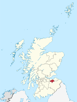
Midlothian ( Gaelic Meadhan Lodainn , more rarely Edinburghshire ) is one of 32 Council Areas in Scotland . It lies south of the Firth of Forth and borders Edinburgh , East Lothian and Scottish Borders . Midlothian is a partner district of the Hungarian Komárom-Esztergom county and the German district of Heinsberg and also one of the Lieutenancy Areas of Scotland.
Midlothian is also a traditional county . As such, Midlothian also includes Edinburgh and is bordered by West Lothian , East Lothian , Berwickshire , Selkirkshire and Peeblesshire .
Cities and villages
- Bonnyrigg
- Crichton
- Dalkeith
- Danderhall
- Gorebridge
- Lasswade
- Loanhead
- Mayfield
- Newton grange
- Penicuik
- Roslin
Attractions
- Rosslyn Chapel
- Scottish Mining Museum , an anchor point on the European Route of Industrial Heritage (ERIH)
- Butterfly and Insect World
- Vogrie Country Park
- Edinburgh Crystal
- Crichton basement
- Crichton Castle
- Castlelaw Hillfort with basement
- Dalkeith Palace
- Pentland Hills
- Roslin Castle
- Water of Leith
- see also List of Category A structures in Midlothian
politics
The Midlothian Council comprises 18 seats, which are distributed among the parties as follows:
| Political party | Seats |
|---|---|
| Labor | 7th |
| SNP | 6th |
| LibDem | 5 |
Individual evidence
- ↑ Mid-2012 Population ( Memento from November 29, 2014 in the Internet Archive ) (PDF; 1.2 MB)
- ↑ Results of the regional elections 2017 ( Memento from September 8, 2017 in the Internet Archive )
Web links
Aberdeen | Aberdeenshire | Angus | Argyll and Bute | Clackmannanshire | Dumfries and Galloway | Dundee | East Ayrshire | East Dunbartonshire | East Lothian | East Renfrewshire | Edinburgh | Falkirk | Fife | Glasgow | Highland | Inverclyde | Midlothian | Moray | Outer Hebrides | North Ayrshire | North Lanarkshire | Orkney | Perth and Kinross | Renfrewshire | Scottish Borders | Shetland | South Ayrshire | South Lanarkshire | Stirling | West Dunbartonshire | West Lothian
Aberdeenshire | Angus | Argyll | Ayrshire | Banffshire | Berwickshire | Bute | Caithness | Clackmannanshire | Cromartyshire | Dumfriesshire | Dunbartonshire | East Lothian | Fife | Inverness-shire | Lanarkshire | Kincardineshire | Kinross-shire | Kirkcudbrightshire | Midlothian | Morayshire | Nairnshire | Orkney | Peeblesshire | Perthshire | Renfrewshire | Ross-shire | Roxburghshire | Selkirkshire | Shetland | Stirlingshire | Sutherland | West Lothian | Wigtownshire