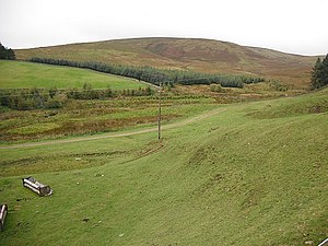
Byrehope mount
| Byrehope mount | ||
|---|---|---|
|
East flank of the Byrehope Mount |
||
| height | 536 m ASL | |
| location | Scottish Borders , Scotland | |
| Mountains | Pentland Hills | |
| Coordinates | 55 ° 46 ′ 41 " N , 3 ° 25 ′ 11" W | |
|
|
||
The Byrehope Mount is a hill in the Pentland Hills . The 536 m high elevation is located in the center of the southern part of the approximately 25 km long range of hills in the Scottish Council Area Scottish Borders .
The nearest town is West Linton, about four kilometers southeast . Tarbrax is eight kilometers west of the western flank of the Pentland Hills. The surrounding hills include Craigengar in the west, Colzium Hill in the northwest, Faw Mount in the west, King Seat in the southeast, and Catstone Hill and Millstone Rig in the southwest.
Surroundings
Several brooks arise on the flanks of the Byrehope Mount. The West Burn , for example, flows from the northwest flank and is dammed to the south-east of the West Water Reservoir , which was established in 1969 and serves as the regional water supply. Furthermore, several source streams of the Baddinsgill Burn arise on the north flank . This does not feed the Baddinsgill Reservoir , but flows directly south of the reservoir into the outflowing Lyne Water .

