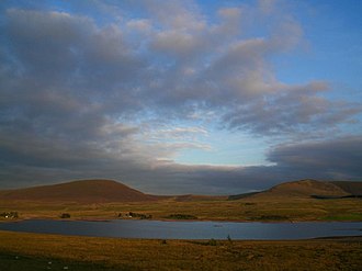
Cauldstane slap
| Cauldstane slap | |||
|---|---|---|---|
|
Northwest end of the Cauldstane Slap |
|||
| Compass direction | Northwest | southeast | |
| Pass height | 441 m | ||
| Scotland | West Lothian | Scottish Borders | |
| Valley locations | Livingston | West Linton | |
| expansion | path | ||
| Mountains | Pentland Hills | ||
| Map (West Lothian) | |||
|
|
|||
| Coordinates | 55 ° 48 '58 " N , 3 ° 24' 38" W | ||
Cauldstane Slap is a pass over the Pentland Hills in Scotland . It marks the border between the neighboring Council Areas West Lothian and Scottish Borders and historically the border between Edinburghshire and Peeblesshire .
geography
About six kilometers southeast of the outskirts of Livingston , the Water of Leith is dammed up off the western flank of the Pentland Hills to form the Harperrig Reservoir . From there a path leads to Coldstane Slap, which marks the saddle point between West Cairn Hill and East Cairn Hill at an altitude of 441 meters . The path continues in a south-southeast direction and meets the Baddinsgill Reservoir between Byrehope Mount and Mount Maw . The path follows the course of the outflowing Lyne Waters to find its southeastern conclusion between Faw Mount and King Seat near West Linton . The entire pass path over the Pentland Hills is around eight kilometers long.
history
Historically, the pass trail was important for the cattle trade until the early 20th century. Up to 150,000 animals were driven over the pass every year. The traders, some of whom came a long way from the Highlands , tried to reach the cattle markets of northern England. This also attracted gangs of thieves who attacked the traders on the pass. That is why the path is still partly marked as Thieves Road even on today's maps . The Covenanters of the 17th century also used the Cauldstane Slap. They held secret meetings in the valleys around the path.
Individual evidence
- ↑ a b Entry in the Gazetteer for Scotland
- ↑ Caldstane Slap : FH Groome (ed.): Ordnance Gazetteer of Scotland: A Survey of Scottish Topography, Statistical, Biographical and Historical , Publishing Works Grange, Edinburgh, 1882-1885.
- ^ The Scotsman: The dark secrets of the Pentlands , June 17, 2005
Web links
- Entry on Cauldstane Slap in Canmore, Historic Environment Scotland database

