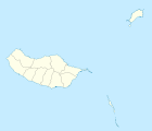
Curral das Freiras
| Curral das Freiras | ||||||
|---|---|---|---|---|---|---|
|
||||||
| Basic data | ||||||
| Autonomous Region : | Madeira | |||||
| Concelho : | Câmara de Lobos | |||||
| Coordinates : | 32 ° 43 ′ N , 16 ° 58 ′ W | |||||
| Residents: | 2001 (as of June 30, 2011) | |||||
| Surface: | 25.03 km² (as of January 1, 2010) | |||||
| Population density : | 80 inhabitants per km² | |||||
| Height: | 400 m | |||||
Curral das Freiras ( German nuns stable , touristy often called Nun called) is a freguesia on the Portuguese Atlantic island of Madeira in Concelho Câmara de Lobos .
The town, 19 kilometers from the island's capital Funchal , is at an altitude of 300 to over 600 m above sea level. NN with 2001 inhabitants (as of June 30, 2011) on 25 km². It is located northeast of Câmara de Lobos and lives mainly from agriculture. Madeira's highest mountain, Pico Ruivo, is in the east.
The place can be reached via a 2.4 km long tunnel. The old pass road is closed to traffic due to the risk of falling rocks.
Curral das Freiras was particularly hard hit by the flood disaster in February 2010.
Individual evidence
- ↑ www.ine.pt - indicator resident population by place of residence and sex; Decennial in the database of the Instituto Nacional de Estatística
- ↑ Overview of code assignments from Freguesias on epp.eurostat.ec.europa.eu
- ↑ n-tv : The greed for profit also killed. In: n-tv.de. February 23, 2010, accessed June 23, 2019 .
Web links
Commons : Curral das Freiras - collection of images, videos and audio files
Wikivoyage: Curral das Freiras - travel guide


