
Cust (New Zealand)
| Cust | ||
| Geographical location | ||
|
||
| Coordinates | 43 ° 19 ′ S , 172 ° 23 ′ E | |
| Region ISO | NZ-CAN | |
| Country |
|
|
| region | Canterbury | |
| District | Waimakariri District | |
| Ward | Oxford-Eyre Ward | |
| Residents | 447 (2013) | |
| height | 130 m | |
| Post Code | 7471 | |
| Telephone code | +64 (0) 3 | |
| Photography of the place | ||
 Main street of Cust |
||

Cust is a village in the Waimakariri District in the Canterbury regionon the South Island of New Zealand .
Origin of name
The village has been renamed several times during its existence. First Moeraki Downs called, followed by the name Carleton and Bennet's Junction before the village finally in honor of the military historian Edward Cust , who is also a founding member of the Canterbury Association was in Cust was renamed.
geography
The place is around 16 km east of Oxford and around 17 km west of Rangiora on the banks of the Cust River . Christchurch city center is around 33 km southeast.
population
At the census in 2013, the place had 447 inhabitants, which means an increase in population of 4.9% compared to the 2006 census.
Infrastructure
traffic
Cust is connected to New Zealand State Higway 71 , which leads directly to Christchurch , via Route 72 and Rangiora .
Education
Cust has a primary school that had 126 students in 2014.
Motorsport
For more than 20 years, the New Zealand Grand Prix for motorcycles was held on a racetrack made of compacted gravel . The last races held at Easter 1963 were attended by up to 25,000 spectators.
See also
Photo gallery

War memorial

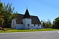
Anglican Church

museum
St. David's Union Church


literature
- Helga Neubauer: Cust . In: The New Zealand Book . 1st edition. NZ Visitor Publications , Nelson 2003, ISBN 1-877339-00-8 , pp. 716 .
Web links
Individual evidence
- ↑ a b 2013 Census QuickStats about a place: Cust . Statistics New Zealand , accessed August 8, 2016 .
- ^ Neubauer: Cust . In: The New Zealand Book . 2003, p. 716 .
- ↑ a b Topo250 maps . Land Information New Zealand , accessed June 3, 2017 .
- ↑ schools database Te Kete Ipurangi, accessed on 25 October 2014
- ↑ The early racing era , cams-racing.org.nz.