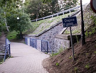
Dajna
|
Dajna Dejna, yours |
||
|
Bridge over the Dajna in Mrągowo (Sensburg) |
||
| Data | ||
| location | Poland | |
| River system | Pregel | |
| Drain over | Guber → Alle → Pregel → Frisches Haff | |
| source | from the Jezioro Wągiel lake near Piecki (Peitschendorf, Gmina Piecki) on the western edge of the Mazurski Park Krajobrazowy 53 ° 48 ′ 22 ″ N , 21 ° 20 ′ 14 ″ E |
|
| Source height | 150 m npm | |
| Mouth height | 62.3 m npm | |
| Height difference | 87.7 m | |
| Bottom slope | 1.6 ‰ | |
| length | 55 km | |
| Catchment area | 345.5 km² | |
| Flowing lakes | Jezioro Wągiel, Jezioro Wierzbowskie, Jezioro Czos, Jezioro Juno, Jezioro Kiersztanowskie, Jezioro Dejnowo | |
| Medium-sized cities | Mrągowo | |
The Dajna [ dajˈna ] (German: yours ) is a left tributary of the Guber in the Polish Warmian-Masurian Voivodeship .
geography
The 55 km long river rises from the lake Jezioro Wągiel near Piecki ( Peitschendorf , Gmina Piecki) on the western edge of the Mazurski Park Krajobrazowy landscape protection park . On its course to the north it flows through several lakes of the Sensburger Rinne, such as the Jezioro Wierzbowskie , the Jezioro Czos (Lap Lake), flows past the town of Mrągowo ( Sensburg ), then the Jezioro Juno (Juno Lake), Jezioro Kiersztanowskie (Kerstinower ) lakes See, 1938 to 1945: Kerstensee) and Jezioro Dejnowo to the confluence with the Guber near the village of Biedaszki ( Biedasken , later Groß Neuhof) (Gmina Kętrzyn ) ( Rastenburg , Polish 1945–1946 Rastembork). The catchment area is given as 345.5 km².

