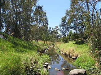
Therein creek
| Therein creek | ||
|
Darebin Creek in Heidelberg West |
||
| Data | ||
| location | Victoria , Australia | |
| River system | Yarra River | |
| Drain over | Yarra River → Port Phillip Bay → Bass Strait | |
| source | at Woodstock 37 ° 30 ′ 49 ″ S , 145 ° 1 ′ 10 ″ O |
|
| Source height | 277 m | |
| muzzle |
Yarra River Coordinates: 37 ° 47 '0 " S , 145 ° 3' 0" E 37 ° 47 '0 " S , 145 ° 3' 0" E |
|
| Mouth height | 18.1 m | |
| Height difference | 258.9 m | |
| Bottom slope | 6 ‰ | |
| length | 42.8 km | |
| Small towns | South Morang, Epping, Lalor, Bundoora, Preston, Ivanhoe, Alphington | |
| Communities | Woodstock, Wollert | |
The Darebin Creek is a creek in the southern Australian state of Victoria .
It flows through the northern suburbs of Melbourne , drains the Darebin Valley and is one of the larger tributaries of the Yarra River . Tens of thousands of years, he served the Wurundjeri , an Aboriginal strain of Kulin , the Woiwurrung spoke as food and utility source.
course
The sources of Darebin Creek are in Wollert near South Morang and even as far as Woodstock , from where the water runs approximately south to Epping.
From there it flows in the north of the urban area of Melbourne, north of Epping , runs approximately south and meets the Yarra River at Alphington . It represents the boundary between the Local Government Areas of Darebin City and Banyule City over long distances . Darebin Creek used to dry out in summer, but the increased runoff of rainwater on the increasingly urbanized banks now ensures permanent water flow.
The creek runs through Darebin Parklands and Rockbeare Park , a large nature reserve about two kilometers northwest of the confluence with the Yarra River. The Darebin Creek Trail , a hiking trail, runs along the banks of the lower reaches .
Parks
Remnants of Melbourne's early agriculture can be seen in the Darebin Parklands in Alphigton and Ivanhoe. The olive trees and fruit trees in the park are more than 100 years old. The Darebin Creek Trail connects many of the parks because it follows the lower reaches of the creek for almost its entire length.
The following parks are located on Darebin Creek (sorted upstream):
- Yarra Bend Park
- In it parklands
- Dundas Street Wetlands
- Olympic Park
- Sullivan's Park
- LaTrobe Wildlife Reserve
- Bundoora Park
See also
Web links
Individual evidence
- ↑ a b c Map of Darebin Creek, VIC . Bonzle.com
- ↑ Melway . Issue 36 (2009)
