Deer Island (Gambia)
| Deer Island | ||
|---|---|---|
|
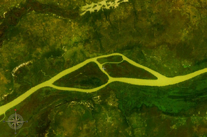
NASA World Wind satellite image : The Gambia flows in a westerly direction in the image section. Deer Island is the eastern and Pasari Island is the western of the two large islands. |
||
| Waters | Gambia (river) | |
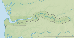
| Geographical location | 13 ° 42 '35 " N , 15 ° 2' 36" W | |
|
|
||
| length | 6 km | |
| width | 1.8 km | |
| Residents | uninhabited | |
Deer Island is an inland island of the Gambia River in the West African state of Gambia .
geography
The island, about six kilometers long and 1.8 kilometers wide, is located around 225 river kilometers upstream from Banjul . The Gambia narrows here in the dividing river arms to a width of about 330 meters and 270 meters. In the immediate vicinity is the island of Pasari Island .
On the right bank of 1485 is hectares large Kahi Badi Forest Park . On the island grow different palm species and baobabs (Baobab). Numerous birds inhabit the uninhabited island, and hippos have been spotted here and there.

