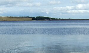
Derwent Reservoir (North East England)
| Derwent Reservoir | |||||||
|---|---|---|---|---|---|---|---|
|
|||||||
|
|
|||||||
| Coordinates | 54 ° 52 ′ 0 ″ N , 1 ° 59 ′ 0 ″ W | ||||||
| Data on the structure | |||||||
| Construction time: | 1960-1966 | ||||||
| Height above the river bed : | 30 m | ||||||
| Height of the structure crown: | 36 m | ||||||
| Crown length: | 914 m | ||||||
| Data on the reservoir | |||||||
| Water surface | 4 km² | ||||||
| Reservoir length | 5.6 km | ||||||
| Total storage space : | 50,000,000 m³ | ||||||
| Catchment area | 110 km² | ||||||
| Outflow tower of the Derwent Reservoir | |||||||
The Derwent Reservoir is a reservoir west of Consett on the border of Northumberland and County Durham in North East England , through which the Derwent flows. The reservoir is located in the North Pennines Area of Outstanding Natural Beauty .
Construction of the reservoir began in 1960 and was completed in September 1966. The Derwent Reservoir was officially opened on July 18, 1967 by HRH Princess Alexandra .
The reservoir is operated by Northumbrian Water and serves to supply drinking water to the Tyne and Wear region .
The reservoir is used by the Derwent Water Sailing Club for sailing. Trout are regularly released in the reservoir, which is a very popular fishing area.
swell
- ↑ Derwent - 40 Facts for 40 years. Northumbrian Water, accessed June 28, 2016 .
- ^ Derwent Reservoir Sailing Club. Retrieved June 28, 2016 .


