Devil's Backbone Open Space
| Devil's Backbone Open Space | ||
|---|---|---|
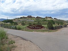
| Entrance to the Devil's Backbone Open Space | ||
|
|
||
| Location: | Colorado , United States | |
| Specialty: | Dakota sandstone formation | |
| Next city: | Loveland | |
| Surface: | 8.9 km² | |
| Founding: | 1996 | |
| Overview of the area | ||
| View through the keyhole towards the front range | ||
Devil's Backbone Open Space is a small sanctuary between the cities of Fort Collins and Loveland in Larimer County in the state of Colorado , USA, administered by the Colorado Department of Natural Resources . It is part of the Larimer County Open Lands Program which was founded in 1996.
geology
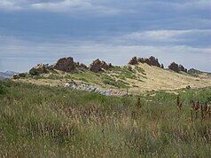
The layers visible here were formed 100 to 50 million years ago on the bottom of the Western Interior Seaway . The Devil's Backbone is a remnant of a very old fold of the earth's crust that arose along with the Rocky Mountains . By folding the sandstone layers were set up and a mountain saddle formed. In the course of time, this was removed again through weathering and erosion. The more stable, still preserved parts of the vertically erected sandstone layers are made of hard Dakota sandstone . These preserved layers now tower above the debris cones that formed from the softer surrounding rock. A special feature is the keyhole , a rock gate that was created by wind and ice. The keyhole is on the western side of the formation and cannot be seen from the parking lot.
Surname
The formation looks like the backbone of the devil lying here is sticking out of the earth above. This formation is one of the most impressive geological landmarks in Larimer County, as well as an important cultural feature of the region and has therefore been placed under protection.
use
Around the Devil's Backbone formation there is an approximately 9 kilometer long, well-developed circular path ( Blue Sky ), while a shorter path ( Wild Loop ) leads east along the formation.
Entry to the area is free, cycling and horse riding are allowed, and visits are only permitted during the day. There is parking, covered picnic areas, and restrooms at the trailhead.
Web links
Individual evidence
- ↑ Archived copy ( Memento of the original from June 28, 2010 in the Internet Archive ) Info: The archive link was inserted automatically and has not yet been checked. Please check the original and archive link according to the instructions and then remove this notice. Description of the geological formation
- ↑ http://www.larimer.org/naturalresources/bbone.cfm Larimer County Parks and Open Land


