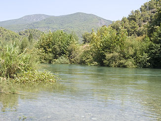
Dim Çayı
| Dim Çayı | ||
| Data | ||
| location | Province of Antalya ( Turkey ) | |
| River system | Dim Çayı | |
| source |
Taurus Mountains 36 ° 37 ′ 15 ″ N , 32 ° 15 ′ 52 ″ E |
|
| Source height | 1790 m | |
| muzzle |
Gulf of Antalya ( Mediterranean ) Coordinates: 36 ° 31 ′ 15 ″ N , 32 ° 3 ′ 16 ″ E 36 ° 31 ′ 15 ″ N , 32 ° 3 ′ 16 ″ E |
|
| Mouth height | 0 m | |
| Height difference | 1790 m | |
| Bottom slope | approx. 45 ‰ | |
| length | approx. 40 km | |
| Reservoirs flowed through | Dim dam | |
| Big cities | Alanya | |
The Dim Çayı is a river to the Mediterranean in the southern Turkish province of Antalya .
The Dim Çayı rises in the Taurus Mountains . It initially flows east and then makes an arc to the right. The Dim Çayı reaches the eastern end of the reservoir of the Dim Dam . Below the dam it flows 9 km before it flows into the Gulf of Antalya on the eastern outskirts of Alanya . The river has a length of about 40 km.
Web links
Commons : Dim Çayı - collection of images, videos and audio files

