Djebel Boukornine
| Djebel Boukornine | ||
|---|---|---|
|
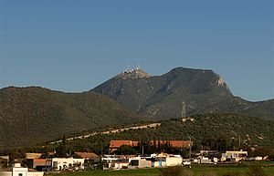
Gulf of Tunis with a view of the Djebel Boukornine |
||
| height | 576 m | |
| location | Tunisia | |
| Coordinates | 36 ° 42 ′ 18 ″ N , 10 ° 20 ′ 0 ″ E | |
|
|
||
The Djebel Boukornine or Djebel Bou Kornine ( Arabic جبل بوقرنين) is a maximum 576 m high coastal mountain range southeast of the Tunisian capital Tunis not far from the Gulf of Tunis . It belongs to the dorsal and essentially consists of two striking peaks, the smaller of which is 493 m high.
Toponym
The name probably comes from the Phoenician Ba'al Kornine , which means something like "Lord with the two horns". The name Balcaranensis has been handed down from Roman times .
Ascent
It is possible to climb both peaks; but there are two weather and radio stations there.
Nature reserve
Almost 2000 hectares of the Djebel Boukornine area are designated as a nature reserve. The predominant trees are Aleppo pine and thuja . Birds of prey and foxes live in the forests and feed on small mammals, but wild boars and porcupines have also been sighted. In 2011 and 2014, parts of the forest fell victim to fires.
See also
Web links
- Franz Cumont : Balcaranensis . In: Paulys Realencyclopadie der classischen Antiquity Science (RE). Volume II, 2, Stuttgart 1896, Col. 2822 f.


