Doberschauer Schanze
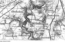
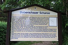
The Doberschauer Schanze ( Upper Sorbian Dobrušanske hrodźišćo , also Skalenburg Dobruš ) is an oval ring wall located about 300 m south of Doberschau in Upper Lusatia above the 30 m high impact slope on the right bank of the Spree , which is only remnants of the earlier fortifications.
In addition to the Budusin (Bautzen) tribal fortress located 4.5 km to the northeast, the Slavic rock castle Dobruš is the most important prehistoric site in the Bautzen area. The rocky steep slope used to be surrounded by the Spree and thus provided excellent protection from the river side. On the other side of the field, a mighty stone / earth wall and strong palisades protected the complex. Thus Dobruš was impregnable fortified around the year 1000. In 1006 King Heinrich II gave Meissen Abbey three castles in the Milzen Gau. The castle is mentioned for the first time in the deed of donation. The » Trebista « mentioned here cannot be clearly located. Historians interpret either Dobruša / Doberschau or Kleindrebnitz near Bischofswerda as Trebista and belonged to the first real estate of the church in Meissen in this region.
In 1223/1241, the third section of the Upper Lusatian border document mentions the narrow strip of land between Sebnitz and Doberschau under the rule of the Bishops of Meißen . This was administered from Dobruš, but since the Burgward constitution was not as prevalent in what would later become Upper Lusatia as it was west of the Elbe, it was quickly forgotten.
investment
The sickle-shaped wall has a base extension of approx. 90 m and was up to 10 m high (without palisades) compared to the northern surroundings. The inner area of the settlement surrounding it can have been approx. 40 × 70 m. The wide fore ditch is still clearly visible today, which separated the fortified settlement even more strongly from the hinterland. The material obtained during the excavation of the trench itself may have been used to build the wall. The old (slightly winding) entrance, which runs around the south and which, in the event of a defense, caused the attacker to show the defender the uncovered right side, can still be seen today. The only access led directly to the southern boundary of the extensive Sichelwall, sharply on the steep slope of the Spree scale .
history
The found material means that it was probably not built and used until after 900. The term "antiquus campus" (German for "old field") mentioned in the border document of 1241 can mean the wide, gentle slope eastwards. The translated field name is given by Worbs in 1795 and then by Meiche. There is no longer any on-site evidence of the often mentioned “Sweden graves”. Oberreit had it listed on a map in 1850. They should then have been between the ski jump and the way to Doberschau. W. Frenzel (map 1930) speculates that these were old Bronze Age barrows, which have been leveled since then.
A legend tells of earlier battles for the Dobruš Castle. “A wild horse army wanted to attack the hamlet of Doberschau first. When the farmers fled to the Skalenburg, the attackers split into two groups that were supposed to storm the castle at the same time and enclose it. The riders, chasing forward blindly, plunged hopelessly into the gruesome depths of the gorge ”(oral communication by E. Klausnitzer. In: Um Bautzen and Schirgiswalde (= values of the German homeland . Volume 12). 1st edition. Akademie Verlag, Berlin 1967, p 107f.).
Climbing on the rocks below the ski jump is prohibited despite the existing climbing routes.
A hiking trail passes above the ski jump. The ski jump is protected as a ground monument. Protection has existed since December 13, 1937 and was renewed on December 1, 1958. Remains of an old shooting range can be seen to the south of the hill.
Individual evidence
- ^ Meiche, A .: The Upper Lusatian border document 1241 and the Burgwarde Ostrusna, Trebista and Godobi. In: New Lusatian Magazine, 84th vol. Görlitz 1908
- ↑ Volksgutkarte. Explanations of the Bautzen sheet and the Schirgiswalde sheet, edited by W. Frenzel (manuscript 1930-35).
- ↑ http://bernievancastle.de/index.php?option=com_content&view=article&id=1301
swell
- Around Bautzen and Schirgiswalde (= values of the German homeland . Volume 12). 1st edition. Akademie Verlag, Berlin 1967, p. 107f.
- Globus: Illustrierte Zeitschrift für Länder- und Völkerkunde, Volume 20, P. 247f in the Google book search
- Glimpses into the patriotic prehistory of Karl Preusker, Volume 1, pp. 193f., Ring walls and oldest dwelling in the area around Camenz and Budissin, and the last city siege in the year 1005. in the Google book search
Coordinates: 51 ° 8 '49 .2 " N , 14 ° 23' 38.2" E


