Drexel Heights
| Drexel Heights | |
|---|---|
|
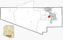
Location in County and Arizona
|
|
| Basic data | |
| State : | United States |
| State : | Arizona |
| County : | Pima County |
| Coordinates : | 32 ° 8 ′ N , 111 ° 2 ′ W |
| Time zone : | Mountain Standard Time ( UTC − 7 ) |
| Residents : | 23,849 (as of: 2000) |
| Population density : | 467.6 inhabitants per km 2 |
| Area : | 51.0 km 2 (approx. 20 mi 2 ) of which 51.0 km 2 (approx. 20 mi 2 ) are land |
| Height : | 770 m |
| FIPS : | 04-20540 |
| GNIS ID : | 0025237 |
Drexel Heights is a census-designated place in Pima County in the US state of Arizona . It has about 26,100 inhabitants (2004 census) on an area of 52.0 km². Interstate 19 runs east of the city and Arizona State Route 86 runs north .
Web links
Commons : Drexel Heights - collection of images, videos and audio files
