Driebergen-Rijsenburg
 flag |
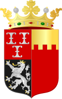
 coat of arms |
| province |
|
| local community |
|
| Residents | 18,645 (Jan. 1, 2017) |
| Coordinates | 52 ° 3 ' N , 5 ° 17' E |
| Important traffic route |
|
| prefix | 0343 |
| Postcodes | 3708-3709, 3711, 3931, 3941, 3945, 3947, 3971 |
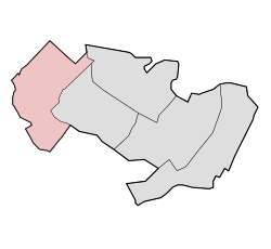
| Location of Driebergen-Rijsenburg in the municipality of Utrechtse Heuvelrug | |
Driebergen-Rijsenburg is a place and a former municipality in the Dutch province of Utrecht . It was formed on May 1, 1931 by the union of the two communities Driebergen and Rijsenburg . On January 1, 2006, it merged with Amerongen, Doorn, Leersum and Maarn to form the new municipality of Utrechtse Heuvelrug . At the time of the dissolution, the municipality Driebergen-Rijsenburg had 18,615 inhabitants on 26.34 km².
Web links
Commons : Driebergen-Rijsenburg - Collection of images, videos and audio files
Individual evidence
- ↑ Kerncijfers wijken en buurten 2017 Centraal Bureau voor de Statistiek , accessed on April 3, 2018 (Dutch)
- ^ Ad van der Meer, Onno Boonstra: Repertorium van Nederlandse gemeenten 1812-2011 . Data Archiving and Networked Services, The Hague 2011, p. 79 ( PDF file; 8.9 MB ).
- ↑ Statline database of the Centraal Bureau voor de Statistiek
