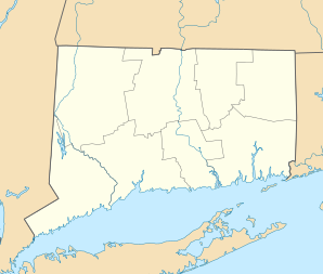
East Hartford
| East Hartford | ||
|---|---|---|
|
Location in Connecticut
|
||
| Basic data | ||
| State : | United States | |
| State : | Connecticut | |
| County : | Hartford County | |
| Coordinates : | 41 ° 46 ′ N , 72 ° 37 ′ W | |
| Time zone : | Eastern ( UTC − 5 / −4 ) | |
| Residents : | 51,252 (as of 2010) | |
| Population density : | 1,097.5 inhabitants per km 2 | |
| Area : | 48.7 km 2 (approx. 19 mi 2 ) of which 46.7 km 2 (approx. 18 mi 2 ) is land |
|
| Height : | 12 m | |
| Postcodes : | 06108, 06118 | |
| Area code : | +1 860 | |
| FIPS : | 09-22630 | |
| GNIS ID : | 0213424 | |
| Website : | www.ci.east-hartford.ct.us | |
| Mayor : | Melody A. Currey | |
East Hartford is a town in Hartford County in the US -amerikanischen State Connecticut with 51,252 inhabitants (2010).
schools
- East Hartford High School
- East Hartford Middle School
- Sunset Ridge School
- Joseph O. Goodwin School
- Hockanum Elementary School
- John A. Langford Elementary School
- Franklin H. Mayberry Elementary School
- Anna E. Norris Elementary School
- Robert J. O'Brien Elementary School
- Thomas S. O'Connell Elementary School
- Gov. William Pitkin Elementary School
- Silver Lane Elementary School
- Woodland School
Web links
Commons : East Hartford - collection of pictures, videos and audio files
