Egelsee (Traubing)
| Egelsee | ||
|---|---|---|

|
||
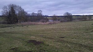
| View of the lake from the south | ||
| Geographical location | Bavaria | |
| Drain | Katzengraben → Wielinger Bach → Weiherbach → Maisinger Bach | |
| Location close to the shore | Traubing | |
| Data | ||
| Coordinates | 47 ° 56 '45.8 " N , 11 ° 16' 10.2" E | |
|
|
||
| Altitude above sea level | 654 m above sea level NN | |
| length | 125 m | |
| width | 125 m | |
The Egelsee is a natural small lake presumably of Ice Age origin near Traubing in Upper Bavaria. On the south side there is a nameless ditch as the main inflow. The runoff is via the Katzengraben to the Wielinger Bach on the north side.
The Egelsee is at least partially fenced and there is no easy access to the shore.
Web links
- [1] Egelsee on the BayernAtlas
