
Eighty Mile Beach

The Eighty Mile Beach , (literally "80-mile-beach"; also Eighty-mile Beach or 80-mile Beach written) is located along the northwest coast of Western Australia. It is roughly halfway between the towns of Broome and Port Hedland . It is a beach about 220 km in length, which forms a coastline where the Great Sandy Desert reaches the Indian Ocean . The beach is one of the premier places for waders in Australia . The wetland of international importance is protected by the Ramsar Convention .
history
Traditional ownership and use
The south facing section of the Eighty Mile Beach is the traditional property of the Aborigines of Nyangumarta caused by many songs, Dreamtime maintain strong narratives and ceremonies relations with the beach and its surroundings. In June 2009, the Nyangumarta received a Native Title for this stretch of beach by the Federal Court of Australia . The court ruling concerned the land right over Nyiyamarri Pukurl, an area adjacent to the Eighty Mile Beach Caravan Park .
Traditional owners of the northern part of Eighty Mile Beach , which is in the vicinity of the dairy farm Anna Plains Station , are half each of Nyangumarta and Garadjari or Karadjari. Both tribes filed a motion to transfer ownership of the overlapping area and were granted a corresponding native title on May 25, 2012. The court ruling concerned the land near Talgarno, a former military compound in the dairy farming area of Anna Plains Station .
In the Karajarri language, the Eighty Mile Beach is also called Wender , which means a creaking noise (German: a creaking noise ). It occurs when walking over drying sand. Today, many Aboriginal people with ties to this land live in the Bidyadanga Community, the former Aboriginal La Grange Mission , and near Frazier Downs . Numerous drinking water resources , called oaks or lirri , are partly deep under the sand surface behind the beach. This water was of great importance to the Aborigines. Many of the oaks were also water reserves on the Kimberley-De Gray drover route , which was used to negotiate long stretches until the 1960s.
Military use
The Talgarno military base, east of Anna Plains Station located was after the Second World War, important for tracking the trajectory and the discovery of the British medium-range missile of the type Blue Streak , which from Woomera in South Australia were started from. An unpaved runway, wells and a raised bunker made of concrete remind of this. In 1999 the Australian Department of Defense tested the missile firing from the Anna Plains Station area when they developed the Jindalee Operational Radar Network .
Wader research
The Eighty Mile Beach has been classified as an Important Bird Area (IBA) because of its importance for waders . It is one of the most important places for wading bird research in Northwest Australia. As a base of more than 400,000 waders, of about one per cent of the global population of bar-tailed godwit , Isabellbrachvogel , Great Knot , Knot , red-necked stint , Gray-tailed tattler , Terek Sandpipers , Australian beach runners , Sand Plover , Plover , Red-headed plover and Orient Brachschwalbe with other irregularly high attendance figures other Species. Annual bird ringing and counting of wading birds have been taking place since 1981 as part of a long-term program to record bird populations on the Asia-Australasian bird flight route . Since 1992, most captured birds have been tagged on their feet in order to research their exact flight paths and whereabouts.
description
geography

The Eighty Mile Beach is the Dampierland -Bioregion in the Shire of Broome in the Kimberley of Western Australia. The beach extends southwest from Cape Missiessy ( position ) in a flat curve to Cape Keraudren ( position ) and finds its center ( position ) here.
The beach is about 100 m wide and has a slight slope. It consists of sand with a high proportion of shell debris and is subject to a strong tidal range of up to 9 meters. The tidal flats connected to the beach vary in width from one to five kilometers. The inland side is bounded by dunes, followed by a narrow floodplain and further inland a strip of land, called Pindan , a local savannah or bushland. Most of the land along the coast is farmed by four large cattle breeding stations, Anna Plains Station, Mandora Station , Wallal Station, and Pardoo Station .
climate
The climate is semi- arid due to the monsoons, with warm, humid summers and warm, dry winters. Mean to average rainfall amounts between 327 and 341 mm or there is an annual evaporation of 3500 mm. The amounts of precipitation are different, which vary greatly depending on the rainy season. This depends on the tropical cyclones in the period from January to March.
Ramsar Convention
Approximately 1,750 km² of the beach and land attached to it, as well as the Mandora Marsh, was declared a Ramsar Site 480 area on June 7, 1990
Mandora Marsh
Mandora Marsh , also called Mandora Salt Marsh , forms various wetland complexes based on a paleo river system. They are located in the area of the Mandora Station with its end in the west, 30 kilometers from Eighty Mile Beach at the beginning of the Great Northern Highway at the western end of the great sandy desert in which the bioregion is located. Located on the Eighty Mile Beach Ramsar Site , it is of great importance to the environment there.
flora
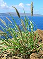
Along the beach, the offshore dunes are stabilized by Green Birdflower ( Crotalaria cunninghamii ) and Beach Spinifex ( Spinifex longifolius ). Downstream, parallel calcareous dune ridges and depressions are usually overgrown by Dune Wattle ( Acacia bivenosa ). Important grasses are the Whiteochloa airoides and the locally endemic Triodia epactia , a resin-rich nest-forming species. The inland grassland has been greatly changed by intensive grazing and is dominated by introduced grass species such as buffalo grass ( Cenchrus ciliaris ) and birdwood grass ( Cenchrus setiger ).
Buffalo grass ( cenchrus ciliaris )


fauna
The significant value of Eighty Mile Beach lies in the presence of a very large number of wading birds, for which it is not a breeding but resting place on the East Asian-Australasian flight path. It is regularly visited by more than 400,000 birds. The beach is particularly important as a resting place for birds that migrate south from their breeding grounds from their higher latitudes in northern Asia and Alaska to spend the summer in Australia in the southern hemisphere. It is one of the most important resting places for the Great Knutt migration and supports at least one percent of the population of migratory birds (or one percent of the population of the remaining bird species) of the 17 waders and the predatory tern . The most common wading bird species on the beach are great knot (more than 169,000 have been counted), common woodcock (110,000) and red knot (80,000). Other notable species on the beach, including the crescent beach runner (60,000), are red-necked stint (60,000), Sand Plover (64,000) and steppe plover (Charadrius veredus) (57,000) pointed tail beach runners (25,000) at both beaches and floodplains and swamps and the Little Curlew (12,000) in the floodplains.


Barrier reef turtles nest in scattered spots on Eighty Mile Beach between October and April . Coastal plains in the southern areas of Anna Plains Homestead are strongholds of the Australian Bustard , which also support a high density of red giant kangaroos . The western part of Wallal Downs has a dense population of mountain kangaroos .
Tourism and beach access
Eighty Mile Beach attracts relatively little interest from tourists, but the trend is increasing. A caravan park has been set up on Wallal Downs , an access point to the beach that is 250 km north of Port Hedland and 365 km south of Broome. It is also frequented by anglers, shell collectors and those looking for relaxation on the beach.
swell
- Livesey, NJG (1993) Eighty-Mile Beach Area: supporting documentation for inclusion on the register of the National Estate: report to the Australian Heritage Commission and the Heritage Council of Western Australia, August 1993 Murdoch, WA: Murdoch University. NEDP documentation; no. 3:93
- Minton, Clive: The history of wader studies in north-west Australia . In: Stilt . 50, 2006, pp. 224-234.
- Stewart, RR (2005) Biophysical resource assessment of the Canning Coast, WA, including Roebuck Bay, Lagrange Bay and Eighty Mile Beach other authors - K. Fitzgerald and P. Kindleysides. Fremantle, WA: Dept. of Conservation and Land Management, Marine Conservation Branch, Data report: MRI / CAN, EMB / RBL, EMB-66/2005
Web links
- The Annotated Ramsar List: Australia . The Ramsar Convention on Wetlands. January 4, 2000. Retrieved April 14, 2010.
- Information Sheet on Ramsar Wetlands: Eighty-mile Beach ( MS Word ; 130 kB) Department of Conservation and Land Management, Western Australia. November 2003. Retrieved April 14, 2010.