Ellis Ridge
| Ellis Ridge | ||
|---|---|---|
|
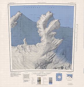
Topographic map (1: 250,000) with Jenkins Heights and the Klinger Ridge at the base of the Martin Peninsula (below) |
||
| location | Marie Byrd Land , West Antarctica | |
| part of | Jenkins Heights | |
|
|
||
| Coordinates | 74 ° 45 ′ S , 113 ° 54 ′ W | |
Ellis Ridge is an icy, 16 km long and 4 km wide mountain ridge on the Walgreen Coast of the West Antarctic Marie Byrd Land . It extends as the foothills of Jenkins Heights south of the Martin Peninsula in a northeastern direction between the Dorchuck Glacier and the Keys Glacier .
The United States Geological Survey (USGS) mapped it using its own surveys and aerial photographs by the United States Navy from 1959 to 1967 and Landsat surveys from 1972 to 1973. The Advisory Committee on Antarctic Names named it after Melvin Y. Ellis, USGS cartographer for satellite-supported surveying work on the Amundsen-Scott South Pole Station in the Antarctic winter of 1974.
Web links
- Ellis Ridge in the Geographic Names Information System of the United States Geological Survey (English)
- Ellis Ridge on geographic.org (English)

