Emu Point
| Emu Point | |||||||
|---|---|---|---|---|---|---|---|
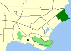
 Map of Albany with Emu Point marked in dark green |
|||||||
|
|||||||
|
|||||||
|
|||||||
|
|||||||
|
|
|||||||
Emu Point is a district of Albany in the Australian state of Western Australia .
geography
Emu Point is about six and a half kilometers northeast of central Albany on the seashore. The headland of Emu Point separates King George Sound from Oyster Harbor . Opposite the natural canal is Gull Rock National Park .
There are beaches as well as a harbor for motor boats and sailing ships in the sheltered Oyster Harbor . Emu Point is home to Bowell Square and Boronia Reserve .
To the west, the district is bordered by Collingwood Heights , to the north by Bayonet Head and to the south by Collingwood Park .
The suburb can be reached with the 803 bus.
population
The town of Emu Point had a population of 316 people in 2016, of which 43.1% male and 56.9% female.
The average age at Emu Point is 68 years, 30 years above the Australian average of 38 years.
Web links
Individual evidence
- ↑ Australian Bureau of Statistics : Emu Point ( English ) In: 2016 Census QuickStats . June 27, 2017. Retrieved September 6, 2019.

