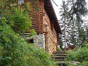
Enderlinhütte
| Enderlinhütte SAC hut |
||
|---|---|---|
| location | on the southern flank of the Falknis ; Graubünden , Switzerland ; Valley location: Maienfeld | |
| Mountain range | Rätikon | |
| Geographical location: | 760 571 / 211910 | |
| Altitude | 1501 m above sea level M. | |
|
|
||
| owner | SAC -Piz Sol | |
| Built | 1900, new building in 1956, expanded in 1976 | |
| Construction type | Hut; Wood | |
| Usual opening times | May to the end of October | |
| accommodation | 0 beds, 34 when manned , 17 emergency camps | |
| Web link | Website of the section | |
| Hut directory | SAC | |
The Enderlinhütte is a mountain hut in the canton of Graubünden ( Switzerland ). It is located northeast of Maienfeld at an altitude of 1501 m above sea level. M. on the southern flank of the Falknis .
The hut, built by Fortunat Enderlin at the turn of the century, was taken over by the Swiss Alpine Club (SAC) Piz Sol in 1922 . The hut at that time was at 1460 meters and offered space for 8 people. In 1956 a new building was built, which was expanded in 1976 and 2002.
Today's hut offers 34 beds and is partially served in the summer season from June to mid-October. The hut is closed in winter.
Accesses
Always straight ahead from Maienfeld train station . The Enderlinweg is the only access to the hut. It cannot be used in the winter months. Hunziger classifies the route as T3.
The further ascent to the Falknis is marked in blue and white.
literature
- Manfred Hunziker: Ringelspitz / Arosa / Rätikon , Alpine Touren / Bündner Alpen , Verlag des SAC 2010, ISBN 978-3-85902-313-0 , p. 523.
Individual evidence
- ↑ SAC Club hut album 1928/1931 , 1937/1946 supplemented, graphic arts institution Brunner & Cie. A.-G., Zurich

