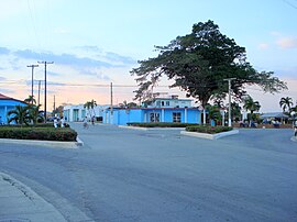
Entronque de Herradura
| Entronque de Herradura | |
|---|---|
|
Coordinates: 22 ° 26 ′ N , 83 ° 27 ′ W
Entronque de Herradura on the map of Cuba
|
|
| Basic data | |
| Country |
|
| province | Pinar del Río |
| City foundation | 1907 |
| Residents | 9828 (2011) |
| Detailed data | |
| surface | 59.84 km 2 |
| Population density | 164 inhabitants / km 2 |
| height | 65 m |
| prefix | + 53-8 |
| Time zone | UTC -5 |
Entronque de Herradura is a concejo and a city in the Cuban province of Pinar del Río .

