Falca Lines
The Falca Lines are a fortification built on Malta near Naxxar during the reign of the Order of St. John from 1731 .
topography
The flat northern part of the island is traversed by three mountain ranges running parallel from west to east, the Mellieha Ridge, the Bajda Ridge and the Marfa Ridge . To the south of these mountain ranges there is a 50 to 100 m high fault that separates the flat northern part from the higher southern part of the island. This fault is known in English as the Great Fault . It is a natural barrier. It is intersected by the Tas Santi Gap and Bingemma Gap in the west, the Falca Gap in the middle and the Naxxar Gap in the east. In addition to these wide incisions, which the British called Gap - German gate , there are also a number of narrower incisions, which are called wied in Maltese . This name is derived from the Arabic wadi . These Wieds usually carry water in winter and are heavily overgrown, but dry out in summer. The fault does not extend all the way to the east coast of the island, here it merges into a flat ridge several hundred meters wide in the area of Madlienna. Troops landed in the north of the island would have to overcome this natural barrier, whereby only the mentioned gaps and the flat coast in the east were available for the movements of larger troop bodies.
prehistory
During the 17th century, after the Valletta construction was completed , the Order erected a network of observation towers on the islands' coasts. While the Wignacourt Towers , built under the rule of the Grand Master Alof de Wignacourt from 1605 to 1620, still offered a limited opportunity to defend the coastal areas, the Lascaris and Redin Towers built later were only suitable for observation purposes. In 1714 fears of a new invasion of the islands increased. Therefore, from 1720 onwards, coastal batteries, redoubts and defensive lines were built to defend sections of the coastline at risk of landing . A closed line of defense along the coast could not be built in a short time with the available means. The bays in the north of the island proved to be particularly problematic. However, an enemy landed here would have had to pass the passageways through the Great Fault . Therefore it was decided to fortify these passages. First a redoubt was built from 1722 at San Pawl tat-Targa.
Building and construction
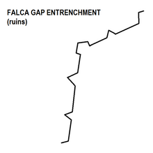
The construction of the facility was based on the redoubts built on the coast. It forms two sides of a trapezoid. The fortified sides faced west and north and leaned against the ridge to the east and south. The extension is about 350 m in north-south and 380 m in west-east direction. A bastion was built at the intersection of the sides, with a half bastion at each end. Between the bastions the curtain popped out into a tenaille .
During the French invasion of Malta in 1798, Grand Master Ferdinand von Hompesch zu Bolheim had the militia regiment from Naxxar take up position in the Falca Lines. However, as French troops under Claude-Henri Belgrand de Vaubois landed in the rear of the position in St George's Bay, the Falca Lines were quickly evacuated.
British colonial times
As part of the fortification of the North West Front , the Dwejra Lines were built from 1873 onwards . After its completion, the Falca Gap in the eastward direction turned out to be problematic . Generals Nicholson and Goodenough investigated the incorporation of the Falca Lines into the North West Front in 1888 . Reconstruction was considered possible at low cost, but was discarded because the position of the line was unfavorable. Ultimately, following Nicholson and Goodenough's proposals, the Victoria Lines infantry line was built further south.
literature
- Stephen C. Spiteri : The Knight's Fortifications: an Illustrated Guide of the Fortifications built by the Knights of St. John in Malta , Book distributors limited, 2001. ISBN 9789990972061 (English)
- Quentin Hughes : Malta. A guide to the fortifications , Said International, 1993. ISBN 9990 943 07 9 (English)
- Ray Cachia Zammit (Editor): The Victoria Lines , Progress Co Ltd, Malta, 1996. ISBN 99909-3-047-3
- Charles Stephenson: The Fortifications of Malta 1530-1945. Osprey Publishing Limited, Wellingborough 2004. ISBN 1-84176-693-3 ( Osprey Fortress Series 16).
Coordinates: 35 ° 54 ′ 45 ″ N , 14 ° 24 ′ 2 ″ E


