Farren hack
|
Farren hack
City of Remscheid
Coordinates: 51 ° 12 ′ 14 " N , 7 ° 11 ′ 56" E
|
||
|---|---|---|
| Height : | 234 m above sea level NN | |
| Postal code : | 42855 | |
| Area code : | 02191 | |
|
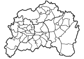
Location of Farrenbracken in Remscheid |
||
|
Farren hack
|
||
Farrenbracken is a court in the Remscheid district of Lüttringhausen . It lies between Clarenbach , Grüne and Birgden III .
history
" Varenbrak " was first mentioned in a document in 1312 and " Farenbraike " around 1547 . From 1597 the court was named Farrenbraake, Varrenbrach, Varenbrach and Farenbreck, later 1612 Varrenbracken and 1683 “ Varenbrachen ” can be read. The name suggests that it used to be a fallow land overgrown by ferns that was plowed up - that is, cleared.
In 1694, in connection with a division of the estate, there was talk of a “ stone academy of the Farenbraken court ”, which suggests that there was probably a kind of fixed tower at the farm of Christoffel Laun zu Farrenbracken during the Thirty Years War , where in troubled times, the residents of the court took refuge. Such defense towers were also called "Steengaden".
Theiss Goldenberg (1642–1710) and his younger brother Franz Gördt Goldenberg (1658–1720) operated several hammers below Kradenholl am Leyerbach together with their brother-in-law Wilhelm Reinshagen in Farrenbracken , according to research by Ernst Erwin Stursberg .
In 1815/16 there were 60 people living in the village. In 1832 Birgden was part of the Hohenhagen honors , which belonged to the mayor's office in Lüttringhausen . According to the statistics and topography of the Düsseldorf administrative district , the place called a hamlet had seven residential buildings, three factories or mills and seven agricultural buildings at that time. At that time, 75 residents lived in the place, 73 Protestant and two Catholic faith. In the municipality lexicon for the province of Rhineland from 1888, five houses with 68 inhabitants are given.
geography
The narrow thoroughfare connects Langenhaus via "Neuland" and "Grüne" with Ronsdorfer Straße. A small stream that marks a valley cut, as it is still widely known from Middle Low German as Siepen in this region , rises above the Hofschaft and flows as "Farrenbrackener Siepen" beyond Ronsdorfer Strasse into the Leyerbach . Up until the 1960s there were a number of farms here, one of which remained. Several craft businesses are based on Farrenbracken.
Monuments
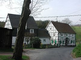
A ravine branches off the connecting path between the Grüner and Spelsberg, which was once used as a coal path, and is marked as a natural monument . It ends in a northerly direction on the meadows above Farrenbracken. The half-timbered house Farrenbracken 1 is on the city's list of monuments
literature
- Hans Kadereit: Where there is still celebrations, reels and delights , a historical illustrated book Lüttringhausen, RGA-Buchverlag, 2009, ISBN 978-3-940491-07-7
- Dr. Wilhelm Rees: Local history booklets of the Remscheid City Archives No. 7
- Bergischer Geschichtsverein Dept. Remscheid: "Bergische Wegweiser, Personalities and families from Remscheid, Lennep and Lüttringhausen" - E. Erwin Stursberg
Individual evidence
- ↑ Johann Georg von Viebahn : Statistics and Topography of the Administrative District of Düsseldorf , 1836
- ↑ Königliches Statistisches Bureau (Prussia) (Ed.): Community encyclopedia for the Rhineland Province, based on the materials of the census of December 1, 1885 and other official sources, (Community encyclopedia for the Kingdom of Prussia, Volume XII), Berlin 1888.

