Fasta Åland
| Fasta Åland | ||
|---|---|---|
| Main town Mariehamn | ||
| Waters | Baltic Sea | |
| Archipelago | Åland archipelago | |
| Geographical location | 60 ° 9 ′ N , 19 ° 47 ′ E | |
|
|
||
| length | 50 km | |
| width | 45 km | |
| surface | 1 010 km² | |
| Highest elevation |
Orrdalsklint 129 m |
|
| Residents | 26,760 (December 2014) 26 inhabitants / km² |
|
| main place | Mariehamn | |
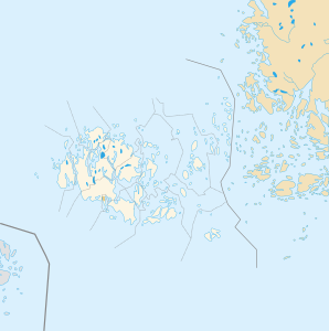
Fasta Åland (in Finnish Manner-Ahvenanmaa or Ahvenanmanner ) is the main island of the Åland archipelago.
Strictly speaking, it is an archipelago of several large islands, but they are very close to one another and are connected by bridges. For example, Eckerö is actually its own island, but it is counted as part of Fasta Åland.
Fasta Åland measures about 50 kilometers in north-south and 45 kilometers in west-east. With an area of 1010 km², it is the largest island in the Baltic Sea waters of Finland . Fasta Åland takes up around 70% of the area of the autonomous province of Åland, nine out of ten Ålanders live on the main island. In addition to the provincial capital Mariehamn , the municipalities of Eckerö , Finström , Geta , Hammarland , Jomala , Lemland , Lumparland , Saltvik and Sund are on Fasta Åland. The highest point on the island is the 129 m high Orrdalsklint .
Individual evidence
- ↑ Website of the Åland Regional Government: Åland at a Glance ( Memento of the original from May 21, 2013 in the Internet Archive ) Info: The archive link has been inserted automatically and has not yet been checked. Please check the original and archive link according to the instructions and then remove this notice. (German; PDF; 1.9 MB)

